Inscription
Elevation — 2704 Feet
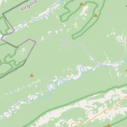
This point marks a spot along the geographical feature known as the Great Eastern Divide. From here water of Sinking Creek flows southwest into the New River. The New River, probably the oldest stream in eastern North America, becomes the Kanawha before joining the Ohio, the Mississippi, and eventually the Gulf of Mexico. From this spot water of Meadow Creek flows northeast to New Castle where it joins Craigs Creek, which in turn flows into the James River and ultimately into the Atlantic Ocean.Details
| HM Number | HM1KYT |
|---|---|
| Tags | |
| Marker Number | KH-2 |
| Year Placed | 1984 |
| Placed By | Virginia Historic Landmark Commission |
| Marker Condition | No reports yet |
| Date Added | Saturday, June 6th, 2015 at 10:01pm PDT -07:00 |
Pictures
Locationbig map


| UTM (WGS84 Datum) | 17S E 569510 N 4144403 |
|---|---|
| Decimal Degrees | 37.44386667, -80.21418333 |
| Degrees and Decimal Minutes | N 37° 26.632', W 80° 12.851' |
| Degrees, Minutes and Seconds | 37° 26' 37.92" N, 80° 12' 51.06" W |
| Driving Directions | Google Maps |
| Area Code(s) | 540 |
| Which side of the road? | Marker is on the right when traveling East |
| Closest Postal Address | At or near VA-42, New Castle VA 24127, US |
| Alternative Maps | Google Maps, MapQuest, Bing Maps, Yahoo Maps, MSR Maps, OpenCycleMap, MyTopo Maps, OpenStreetMap |
Is this marker missing? Are the coordinates wrong? Do you have additional information that you would like to share with us? If so, check in.
Nearby Markersshow on map
Maintenance Issues
- Is this marker part of a series?
- What historical period does the marker represent?
- What historical place does the marker represent?
- What type of marker is it?
- What class is the marker?
- What style is the marker?
- This marker needs at least one picture.
- Can this marker be seen from the road?
- Is the marker in the median?

Comments 0 comments