Inscription
c. 1907
National Register of
Historic Places
Details
| HM Number | HM1PS6 |
|---|---|
| Tags | |
| Placed By | Uptown Tenderloin Historic District |
| Marker Condition | No reports yet |
| Date Added | Friday, December 4th, 2015 at 5:01pm PST -08:00 |
Pictures
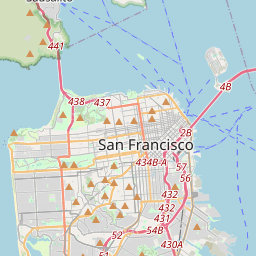
Locationbig map


| UTM (WGS84 Datum) | 10S E 551770 N 4182215 |
|---|---|
| Decimal Degrees | 37.78583333, -122.41205000 |
| Degrees and Decimal Minutes | N 37° 47.15', W 122° 24.723' |
| Degrees, Minutes and Seconds | 37° 47' 9" N, 122° 24' 43.38" W |
| Driving Directions | Google Maps |
| Area Code(s) | 415, 619, 650, 510 |
| Which side of the road? | Marker is on the right when traveling East |
| Closest Postal Address | At or near 445 O'Farrell St, San Francisco CA 94102, US |
| Alternative Maps | Google Maps, MapQuest, Bing Maps, Yahoo Maps, MSR Maps, OpenCycleMap, MyTopo Maps, OpenStreetMap |
Is this marker missing? Are the coordinates wrong? Do you have additional information that you would like to share with us? If so, check in.
Nearby Markersshow on map
Maintenance Issues
- Is this marker part of a series?
- What historical period does the marker represent?
- What historical place does the marker represent?
- What type of marker is it?
- What class is the marker?
- What style is the marker?
- Does the marker have a number?
- What year was the marker erected?
- This marker needs at least one picture.
- Can this marker be seen from the road?
- Is the marker in the median?
Comments 0 comments