Inscription
William C. Clifton worked as a cowpuncher on the Diamond L Ranch. where he acquired the nickname "Diamond L Slim." On March 15, 1903, he shot and killed John W. and Luella Foster Church in the Churches' homestead cabin on Porcupine Creek. Slim was quarreling with the Churches over money that he was supposed to have invested in a joint cattle venture. He tied their corpses together with rope and packed them two-and-a-half miles on a horse to Big Draw Gulch, where he buried them.
The Churches' disappearance caused concern among local herders. Because Slim was known to be the last person to see the couple, he was arrested in Gillette on April 7 on suspicion of murder. Authorities immediately sent Slim to the jail in Newcastle to avoid the formation of a lynch mob in Gillette. Slim confessed to the murder on April 18 in the Newcastle jail.
President Teddy Roosevelt visited Newcastle at the height of the tension surrounding the murders. Local authorities feared that a lynching might take place during the presidents's visit and temporarily moved Slim to a jail in Custer, South Dakota, until the president departed.
Around midnight on May 27, armed vigilantes stormed the Newcastle jail and seized Slim at gunpoint. These men took Slim to the bridge on the main railroad track to the Cambria Mining Company.
Knowing
that a long rope would bring a quicker death, Slim is supposed to have said, "Give me a long drop, boys." The vigilantes use such a long rope that Slime was decapitated instantly.
Legend states that the town undertaker reattached Slim's head backwards. His boy was displayed in the window of a local hardware store prior to being buried.
Side bar on left
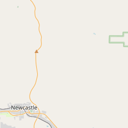
Local authorities moved Slim to several different locations to try and avoid a lynching. Gillette, where Slim was arrested is located 55 miles north of the Churches' homestead site and was a destination for cowpunchers who were friends and neighbors of the Churches. To avoid violence, lawmen in Gillette moved Slim to nearby Newcastle, a town located 75 miles northeast of the Churches' homestead site. He was later move to Custer, South Dakota, which is located 35 miles southeast of Newcastle.
The Churches' disappearance caused concern among local herders. Because Slim was known to be the last person to see the couple, he was arrested in Gillette on April 7 on suspicion of murder. Authorities immediately sent Slim to the jail in Newcastle to avoid the formation of a lynch mob in Gillette. Slim confessed to the murder on April 18 in the Newcastle jail.
President Teddy Roosevelt visited Newcastle at the height of the tension surrounding the murders. Local authorities feared that a lynching might take place during the presidents's visit and temporarily moved Slim to a jail in Custer, South Dakota, until the president departed.
Around midnight on May 27, armed vigilantes stormed the Newcastle jail and seized Slim at gunpoint. These men took Slim to the bridge on the main railroad track to the Cambria Mining Company.
Knowing
that a long rope would bring a quicker death, Slim is supposed to have said, "Give me a long drop, boys." The vigilantes use such a long rope that Slime was decapitated instantly.
Legend states that the town undertaker reattached Slim's head backwards. His boy was displayed in the window of a local hardware store prior to being buried.
Side bar on left
Local authorities moved Slim to several different locations to try and avoid a lynching. Gillette, where Slim was arrested is located 55 miles north of the Churches' homestead site and was a destination for cowpunchers who were friends and neighbors of the Churches. To avoid violence, lawmen in Gillette moved Slim to nearby Newcastle, a town located 75 miles northeast of the Churches' homestead site. He was later move to Custer, South Dakota, which is located 35 miles southeast of Newcastle.
Details
| HM Number | HM1UP0 |
|---|---|
| Tags | |
| Placed By | Wyoming State Parks & Cultural Resources |
| Marker Condition | No reports yet |
| Date Added | Monday, September 26th, 2016 at 5:02pm PDT -07:00 |
Pictures
Locationbig map

| UTM (WGS84 Datum) | 13T E 563829 N 4855996 |
|---|---|
| Decimal Degrees | 43.85430000, -104.20580000 |
| Degrees and Decimal Minutes | N 43° 51.258', W 104° 12.348' |
| Degrees, Minutes and Seconds | 43° 51' 15.48" N, 104° 12' 20.88" W |
| Driving Directions | Google Maps |
| Area Code(s) | 307, 605 |
| Which side of the road? | Marker is on the right when traveling West |
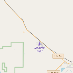
| Closest Postal Address | At or near 218-224 N Railway Ave, Newcastle WY 82701, US |
| Alternative Maps | Google Maps, MapQuest, Bing Maps, Yahoo Maps, MSR Maps, OpenCycleMap, MyTopo Maps, OpenStreetMap |
Is this marker missing? Are the coordinates wrong? Do you have additional information that you would like to share with us? If so, check in.
Nearby Markersshow on map
Maintenance Issues
- Is this marker part of a series?
- What historical period does the marker represent?
- What historical place does the marker represent?
- What type of marker is it?
- What class is the marker?
- What style is the marker?
- Does the marker have a number?
- What year was the marker erected?
- This marker needs at least one picture.
- Can this marker be seen from the road?
- Is the marker in the median?
Comments 0 comments