Inscription
The Barlow Road
—Oregon Trail Mile 1891 —
In the shadow of the tall trees, a stream of travelers crossed ash flows, talus slopes and boggy wetlands along this last stretch of the trail. Some emigrants were forced to abandon their wagons with the death of livestock and walk, carrying their remaining belongings.By 1847, the Barlow Road followed the south bank of the Sandy River through the present day Wildwood Recreation Area. Directly down the trail from this point lay the first crossing of the Sandy River with its swift waters and slippery rocks and then the steep ascent of the ledge known as Devil's Backbone. Oregon City was still an average of five days away.
Tuesday — Came on down into a little glade, where we found some grass and camped for dinner. Here we found the red and white clover, dandelions, strawberries all growing. Came on after dinner over a very good road most of the way. Traveled on about 5 miles and found good grass and a place to camp. We concluded to stop here tonight. We are camped tonight in a little glade with the prettiest trees all around us. As it looks like rain, we pitched our tent and have the bottom carpeted with fir brought to sleep on. We have not seen much game in crossing the mountains but begin to see more as we get lower down. ... — Frank Stevens, July 5, 1881
Came 19 miles today and crossed
Sandy river once and have camp by it about dark fed the stock flour, and cut down alder for them to browse on, nothing else for them, poor things, kept them yoked and tied all night. — Amelia Stewart Knight, September 10, 1853
Our mare appeared much better this morning and we started again on our way going very slowly. Mr. H insisted on my riding one of the mules, which I did and found it much better than walking, but we soon found out that she could not go as she appeared to fail at every step and finally lay down on the roadside. I cannot describe my feelings at this time. This noble animal that has been so much service to us and worth so much to us if we got her through, laid down to die. I burst into a flood of tears. It seemed that trouble and trials came thick and fast upon us, and at a time when we could less bear it. — Esther Belle Hannah ( 18 years) September 15, 1852
Details
| HM Number | HM24E7 |
|---|---|
| Series | This marker is part of the Oregon Trail series |
| Tags | |
| Placed By | Bureau of Land Management |
| Marker Condition | No reports yet |
| Date Added | Saturday, January 6th, 2018 at 1:01pm PST -08:00 |
Pictures
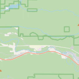
Locationbig map


| UTM (WGS84 Datum) | 10T E 579383 N 5022976 |
|---|---|
| Decimal Degrees | 45.35580000, -121.98650000 |
| Degrees and Decimal Minutes | N 45° 21.348', W 121° 59.19' |
| Degrees, Minutes and Seconds | 45° 21' 20.88" N, 121° 59' 11.4" W |
| Driving Directions | Google Maps |
| Area Code(s) | 503 |
| Which side of the road? | Marker is on the right when traveling East |
| Closest Postal Address | At or near Main Park Rd, Mount Hood Village OR 97067, US |
| Alternative Maps | Google Maps, MapQuest, Bing Maps, Yahoo Maps, MSR Maps, OpenCycleMap, MyTopo Maps, OpenStreetMap |
Is this marker missing? Are the coordinates wrong? Do you have additional information that you would like to share with us? If so, check in.
Nearby Markersshow on map
Maintenance Issues
- What historical period does the marker represent?
- What historical place does the marker represent?
- What type of marker is it?
- What class is the marker?
- What style is the marker?
- Does the marker have a number?
- What year was the marker erected?
- This marker needs at least one picture.
- Can this marker be seen from the road?
- Is the marker in the median?

Comments 0 comments