Inscription
The coastal bluffs of Isadore B. Dockweiler State Beach have played host to modern Hang Gliders since 1966, and are considered to be the birthplace of modern Hang Gliding in the United States. The soft gentle slopes and smooth coastal breezes provide enthusiasts with the ideal environment for learning the art of Hang Gliding flight. Having used a combination of City, County and State resources, we dedicate these new recreational facilities to the sport of Hang Gliding.
Details
| HM Number | HM27VD |
|---|---|
| Tags | |
| Historical Period | 20th Century |
| Historical Place | Park |
| Marker Type | Other |
| Marker Class | Historical Marker |
| Marker Style | Free Standing |
| Year Placed | 2000 |
| Placed By | City and County of Los Angeles |
| Marker Condition |  6 out of 10 (5 reports) |
| Date Added | Monday, May 28th, 2018 at 1:02pm PDT -07:00 |
Pictures


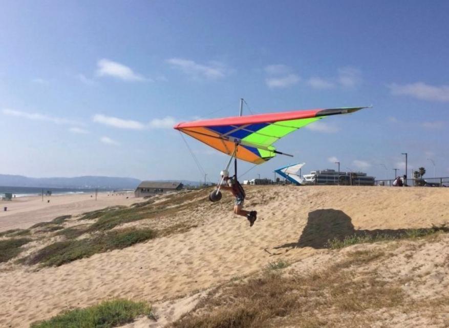

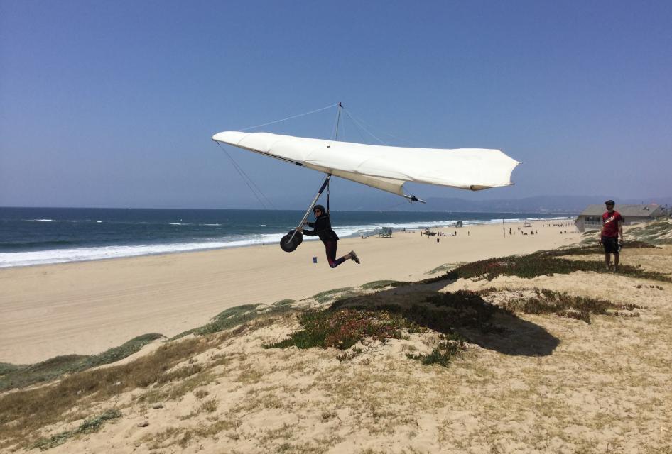
Photo Credits: [1] CRAIG BAKER [2] CRAIG BAKER [3] CRAIG BAKER [4] CRAIG BAKER [5] CB
Locationbig map
| Directions Information | On Vista Del Mar, a half mile south of Imperial Hwy. |
|---|---|
| UTM (WGS84 Datum) | 11S E 367789 N 3754212 |
| Decimal Degrees | 33.92005000, -118.43026667 |
| Degrees and Decimal Minutes | N 33° 55.203', W 118° 25.816' |
| Degrees, Minutes and Seconds | 33° 55' 12.1800" N, 118° 25' 48.9600" W |
| Driving Directions | Google Maps |
| Area Code(s) | 310, 323 |
| Is marker in the median? | No |
| Which side of the road? | Marker is on the right when traveling South |
| Closest Postal Address | At or near 12623 Vista Del Mar, Los Angeles CA 90293, US |
| Alternative Maps | Google Maps, MapQuest, Bing Maps, Yahoo Maps, MSR Maps, OpenCycleMap, MyTopo Maps, OpenStreetMap |
Is this marker missing? Are the coordinates wrong? Do you have additional information that you would like to share with us? If so, check in.
Nearby Markersshow on map
Maintenance Issues
- Is this marker part of a series?
- Can this marker be seen from the road?
Comments 0 comments