Inscription
In the early 1790s, the United States Army suffered two serious defeats at the hands of Indians under the leadership of Little Turtle, war chief of the Miami nation. In response, President George Washington sent Revolutionary War hero Gen. "Mad" Anthony Wayne into the western frontier. He had earned the nickname "Mad" for his reckless daring in a spectacular attack on the British at Stoney Point, New York, during the Revolution.
A stern disciplinarian, Wayne rigorously trained his troops before he took his "Legion of the United States" into Miami territory in 1794. His forces defeated the Indian confederacy at the battle of Fort Recovery, Ohio (July 2, 1794) and then again at the battle of Fallen Timbers, near Toledo (August 20, 1794).
Wayne next moved his "Legion" up the Maumee river to the large Native American settlement of Kekionga at the confluence of the Three Rivers. He chose a site across the Maumee River from Kekionga to build the first American fort and then handed over command to Col. John Hamtramck. On October 22, 1794, the fourth anniversary of the defeat of the United States at the Battle of Kekionga, Hamtramck called together a parade of the garrison, fired 15 rounds of cannon (in honor of each of the fifteen states on the Union), and formally announced that this
place was henceforth to be called Fort Wayne.
Anthony Wayne left Fort Wayne four days later, never to return. After inspecting other U.S. garrisons and successfully negotiating the Treaty of Greenville in 1795 with the Indians of the region, Wayne returned to Pennsylvania where he died in 1796.
Details
| HM Number | HM29AV |
|---|---|
| Tags | |
| Placed By | ARCH, Inc |
| Marker Condition | No reports yet |
| Date Added | Friday, July 13th, 2018 at 10:01am PDT -07:00 |
Pictures
Locationbig map

| UTM (WGS84 Datum) | 16T E 656409 N 4549411 |
|---|---|
| Decimal Degrees | 41.08093333, -85.13800000 |
| Degrees and Decimal Minutes | N 41° 4.856', W 85° 8.28' |
| Degrees, Minutes and Seconds | 41° 4' 51.36" N, 85° 8' 16.8" W |
| Driving Directions | Google Maps |
| Area Code(s) | 260 |
| Which side of the road? | Marker is on the right when traveling West |
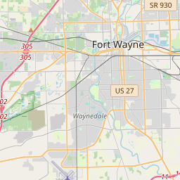
| Closest Postal Address | At or near 201 E Main St, Fort Wayne IN 46802, US |
| Alternative Maps | Google Maps, MapQuest, Bing Maps, Yahoo Maps, MSR Maps, OpenCycleMap, MyTopo Maps, OpenStreetMap |
Is this marker missing? Are the coordinates wrong? Do you have additional information that you would like to share with us? If so, check in.
Nearby Markersshow on map
Maintenance Issues
- Is this marker part of a series?
- What historical period does the marker represent?
- What historical place does the marker represent?
- What type of marker is it?
- What class is the marker?
- What style is the marker?
- Does the marker have a number?
- What year was the marker erected?
- This marker needs at least one picture.
- Can this marker be seen from the road?
- Is the marker in the median?
Comments 0 comments