Inscription
Laurentian Divide
SCENIC OVERLOOK
SUPERIOR
National Forest
You are looking toward Birch Lake located on the Laurentian Divide. Water at this point flows northward into Canada's Hudson Bay watershed and eastward into the Saint Lawrence watershed.
Federal Highway Beautification Project 1966
Details
Pictures
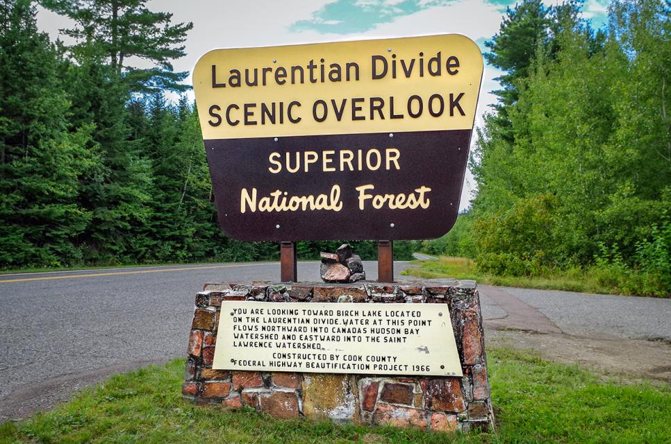
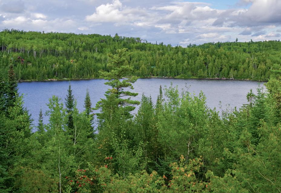

Photo Credits: [1] MARTHA DECKER [2] MARTHA DECKER [3] MARTHA DECKER
Locationbig map
| UTM (WGS84 Datum) | 15U E 682915 N 5326713 |
|---|---|
| Decimal Degrees | 48.06745200, -90.54461700 |
| Degrees and Decimal Minutes | N 48° 4.0471', W 90° 32.677' |
| Degrees, Minutes and Seconds | 48° 4' 2.8272" N, 90° 32' 40.6212" W |
| Driving Directions | Google Maps |
| Area Code(s) | 218 |
| Can be seen from road? | Yes |
| Is marker in the median? | No |
| Which side of the road? | Marker is on the right when traveling West |
| Closest Postal Address | At or near 8406-8450 Gunflint Trail, Grand Marais MN 55604, US |
| Alternative Maps | Google Maps, MapQuest, Bing Maps, Yahoo Maps, MSR Maps, OpenCycleMap, MyTopo Maps, OpenStreetMap |
Is this marker missing? Are the coordinates wrong? Do you have additional information that you would like to share with us? If so, check in.
Nearby Markersshow on map
Show me all markers in: Grand Marais, MN | Cook County | 55604 | Minnesota | United States of America
Comments 0 comments