Inscription
150th Anniversary of Incorporation
The USPS opened a post office in town on July 28, 1851, calling it San Juan, and on September 6, 1869, the Monterey County Board of Supervisors approved officially incorporated the town with the title of, "The Inhabitants of the Town of San Juan." The Postal Service continued to use the name San Juan until November 16, 1905, when they re-named it San Juan Bautista.The Volunteer Fire Department and City Hall have been closely linked from the beginning. In 1868, the Eagle Hook and Ladder Company was established.
In 1871, town trustees built a fire truck house, adding a City Council room in 1893. That fire truck house/city hall moved to this site in 1917, where it remained until 1946. In 1946, Mr. And Mrs. Arthur Nyland funded a civic center in honor of their son Robert, killed in WWII. They first donated a large plot of land to the fire department, who then gave half to the city. On September 22, 1957, the current City Hall located around the corner on Second Street, was established.
Dedicated to The Inhabitants of the Town of San Juan(Bautista), City of History, and its vibrant sense of community on September 7, 2019
Monterey Viejo Chapter 1846 E Clampus Vitus
Details
| HM Number | HM2KHD |
|---|---|
| Tags | |
| Year Placed | 2019 |
| Placed By | E Clampus Vitus Monterey Viejo Chapter 1846 |
| Marker Condition | No reports yet |
| Date Added | Saturday, September 7th, 2019 at 11:02am PDT -07:00 |
Pictures
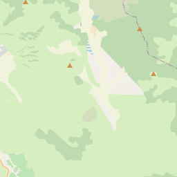
Locationbig map


| UTM (WGS84 Datum) | 10S E 630415 N 4078729 |
|---|---|
| Decimal Degrees | 36.84548333, -121.53726667 |
| Degrees and Decimal Minutes | N 36° 50.729', W 121° 32.236' |
| Degrees, Minutes and Seconds | 36° 50' 43.74" N, 121° 32' 14.16" W |
| Driving Directions | Google Maps |
| Which side of the road? | Marker is on the right when traveling East |
| Closest Postal Address | At or near , , |
| Alternative Maps | Google Maps, MapQuest, Bing Maps, Yahoo Maps, MSR Maps, OpenCycleMap, MyTopo Maps, OpenStreetMap |
Is this marker missing? Are the coordinates wrong? Do you have additional information that you would like to share with us? If so, check in.
Nearby Markersshow on map
Show me all markers in:
Maintenance Issues
- What country is the marker located in?
- Is this marker part of a series?
- What historical period does the marker represent?
- What historical place does the marker represent?
- What type of marker is it?
- What class is the marker?
- What style is the marker?
- Does the marker have a number?
- This marker needs at least one picture.
- Can this marker be seen from the road?
- Is the marker in the median?

Comments 0 comments