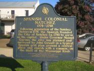
Inscription
1779 ~ 1798
Following acquisition of the Natchez District in 1779, the Spanish founded the City of Natchez ca.1790 to serve as the capital. Under Governor Manuel Gayoso, the city was planned and surveyed by John Girault in a typical Spanish grid plan around a central plaza and church with a common, on the bluff of the Mississippi River.Dedicated March 27, 1998
by the Mississippi State Society Daughters of the American Revolution,
Mrs. Erwin Connel Ward, State Regent,
to commemorate the bicentennial of the United States' taking possession of Natchez from Spain, March 30, 1798.
Details
| HM Number | HM6H7 |
|---|---|
| Series | This marker is part of the Daughters of the American Revolution series |
| Tags | |
| Year Placed | 1998 |
| Placed By | Mississippi State Society Daughters of the American Revolution |
| Marker Condition | No reports yet |
| Date Added | Friday, October 24th, 2014 at 11:54am PDT -07:00 |
Pictures
Locationbig map
| UTM (WGS84 Datum) | 15R E 651192 N 3492951 |
|---|---|
| Decimal Degrees | 31.56166667, -91.40695000 |
| Degrees and Decimal Minutes | N 31° 33.7', W 91° 24.417' |
| Degrees, Minutes and Seconds | 31° 33' 42.00" N, 91° 24' 25.02" W |
| Driving Directions | Google Maps |
| Area Code(s) | 601, 769 |
| Closest Postal Address | At or near 107 S Broadway St, Natchez MS 39120, US |
| Alternative Maps | Google Maps, MapQuest, Bing Maps, Yahoo Maps, MSR Maps, OpenCycleMap, MyTopo Maps, OpenStreetMap |
Is this marker missing? Are the coordinates wrong? Do you have additional information that you would like to share with us? If so, check in.
Nearby Markersshow on map
Bluff Park - Memorials and Louisiana Connections
Natchez
Richard N. Wright
Bluff Park - Playground for the City
Bluff Park and South Broadway Street
The Natchez Trace
Silver Street and Natchez Under-the-Hill
Ealey Brothers
Intersection of State and South Canal streets
Intersection of South Broadway and Washington streets
Maintenance Issues
- What historical period does the marker represent?
- What historical place does the marker represent?
- What type of marker is it?
- What class is the marker?
- What style is the marker?
- Does the marker have a number?
- This marker could use another picture or two.
- Can this marker be seen from the road?
- Is the marker in the median?

Comments 0 comments