Inscription
[Front]:
This house was built in 1843 for William Thompson Nuckolls (1801-1855) and later owned for many years by John D. Jefferies (1838-1910). Built in the Greek Revival style of the antebellum period and altered in the Neo-Classical style of the post-Civil War era, it is a fine example of a mid-19th century plantation house with significant late-19th century alterations.
[Reverse]:
William T. Nuckolls, a lawyer and politician, had represented what was then Spartanburg District in the U.S. House of Representatives 1827-1833. This house passed through several owners after his death until 1875, when Capt. John D. Jefferies, a Confederate veteran and business-man, aquired it. The house was listed in the National Register of Historic Places in 2007.
Details
| HM Number | HMBLX |
|---|---|
| Series | This marker is part of the South Carolina: Cherokee County Historical and Preservation Society series |
| Tags | |
| Marker Number | 11-8 |
| Year Placed | 2008 |
| Placed By | Cherokee Historical and Preservation Society Inc |
| Marker Condition | No reports yet |
| Date Added | Thursday, September 25th, 2014 at 9:54pm PDT -07:00 |
Pictures
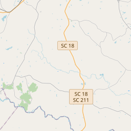
Locationbig map


| UTM (WGS84 Datum) | 17S E 439959 N 3865505 |
|---|---|
| Decimal Degrees | 34.93025000, -81.65740000 |
| Degrees and Decimal Minutes | N 34° 55.815', W 81° 39.444' |
| Degrees, Minutes and Seconds | 34° 55' 48.90" N, 81° 39' 26.64" W |
| Driving Directions | Google Maps |
| Area Code(s) | 864 |
| Closest Postal Address | At or near 477-487 Asbury Rd, Pacolet SC 29372, US |
| Alternative Maps | Google Maps, MapQuest, Bing Maps, Yahoo Maps, MSR Maps, OpenCycleMap, MyTopo Maps, OpenStreetMap |
Is this marker missing? Are the coordinates wrong? Do you have additional information that you would like to share with us? If so, check in.
Nearby Markersshow on map
Show me all markers in: Pacolet, SC | Cherokee County | 29372 | South Carolina | United States of America
Maintenance Issues
- What historical period does the marker represent?
- What historical place does the marker represent?
- What type of marker is it?
- What class is the marker?
- What style is the marker?
- This marker needs at least one picture.
- Can this marker be seen from the road?
- Is the marker in the median?

Comments 0 comments