Inscription
By concurrent legislative acts passed by New Jersey, February 18th, 1811 and by Pennsylvania, March 23rd, 1811, authority was granted the Centre Bridge Company to construct a bridge across the river at this point.
The original bridge was constructed of timber of the covered type and opened for travel in the Spring of 1814. The structure remained in service until struck by lightening July 22nd, 1923 and totally destroyed.
Through the efforts of Senators Clarence J. Buckman of Pennsylvania and David H. Agans of New Jersey, appropriations were secured for the purchase and rebuilding of the structure.
The joint commission of Pennsylvania and New Jersey purchased the propery November 6th, 1925 and constructed the present structure which was opened July 16th, 1927.
Samuels S. Lewis - President
Samual S. Lewis Gifford Pinchot · Edward Martin · Clarence J. Buckman
New Jersey:
S.E. Kaufman · Louis Focht · Fred R. Parker · Joseph Cooper · Walter I. Jacoby
Details
| HM Number | HMD8L |
|---|---|
| Tags | |
| Marker Condition | No reports yet |
| Date Added | Sunday, September 28th, 2014 at 11:19pm PDT -07:00 |
Pictures
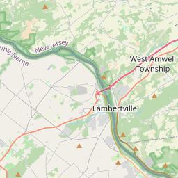
Locationbig map

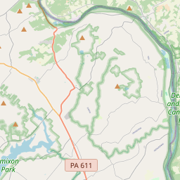


| UTM (WGS84 Datum) | 18T E 501797 N 4472612 |
|---|---|
| Decimal Degrees | 40.40411667, -74.97881667 |
| Degrees and Decimal Minutes | N 40° 24.247', W 74° 58.729' |
| Degrees, Minutes and Seconds | 40° 24' 14.82" N, 74° 58' 43.74" W |
| Driving Directions | Google Maps |
| Area Code(s) | 609, 908 |
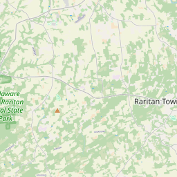
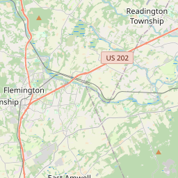
| Closest Postal Address | At or near 1 Bridge St, Stockton NJ 08559, US |
| Alternative Maps | Google Maps, MapQuest, Bing Maps, Yahoo Maps, MSR Maps, OpenCycleMap, MyTopo Maps, OpenStreetMap |
Is this marker missing? Are the coordinates wrong? Do you have additional information that you would like to share with us? If so, check in.
Nearby Markersshow on map
Show me all markers in: Stockton, NJ | Hunterdon County | 08559 | New Jersey | United States of America
Maintenance Issues
- Is this marker part of a series?
- What historical period does the marker represent?
- What historical place does the marker represent?
- What type of marker is it?
- What class is the marker?
- What style is the marker?
- Does the marker have a number?
- What year was the marker erected?
- Who or what organization placed the marker?
- This marker needs at least one picture.
- Can this marker be seen from the road?
- Is the marker in the median?
Comments 0 comments