Inscription
The Italian freighter Etrusco, a 7000 ton liberty ship, grounded here March 16, 1956, in a northeast blizzard. All hands safe. Refloated November 22, 1956.
Placed by the Cedar Point Association on the 30th anniversary of grounding and the 350th year of Scituate's incorporation.
Placed by the Cedar Point Association on the 30th anniversary of grounding and the 350th year of Scituate's incorporation.
Details
| HM Number | HMFJE |
|---|---|
| Tags | |
| Year Placed | 1986 |
| Placed By | The Cedar Point Association |
| Marker Condition | No reports yet |
| Date Added | Monday, October 6th, 2014 at 10:37am PDT -07:00 |
Pictures
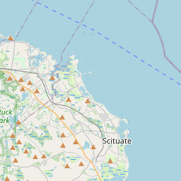
Locationbig map


| UTM (WGS84 Datum) | 19T E 358354 N 4673936 |
|---|---|
| Decimal Degrees | 42.20476667, -70.71581667 |
| Degrees and Decimal Minutes | N 42° 12.286', W 70° 42.949' |
| Degrees, Minutes and Seconds | 42° 12' 17.16" N, 70° 42' 56.94" W |
| Driving Directions | Google Maps |
| Area Code(s) | 617, 781, 339 |
| Closest Postal Address | At or near 85-99 Lighthouse Rd, Scituate MA 02066, US |
| Alternative Maps | Google Maps, MapQuest, Bing Maps, Yahoo Maps, MSR Maps, OpenCycleMap, MyTopo Maps, OpenStreetMap |
Is this marker missing? Are the coordinates wrong? Do you have additional information that you would like to share with us? If so, check in.
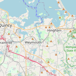
Nearby Markersshow on map
Show me all markers in: Scituate, MA | Plymouth County | 02066 | Massachusetts | United States of America
Maintenance Issues
- Is this marker part of a series?
- What historical period does the marker represent?
- What historical place does the marker represent?
- What type of marker is it?
- What class is the marker?
- What style is the marker?
- Does the marker have a number?
- This marker needs at least one picture.
- Can this marker be seen from the road?
- Is the marker in the median?
Comments 0 comments