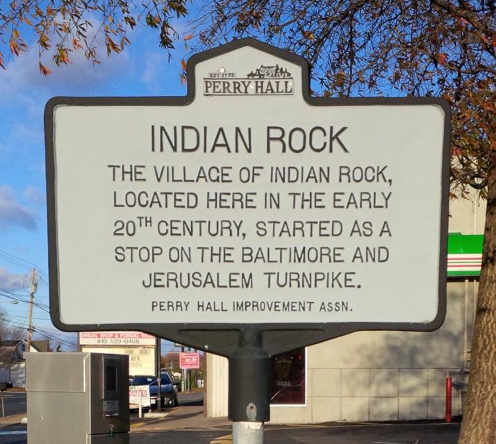
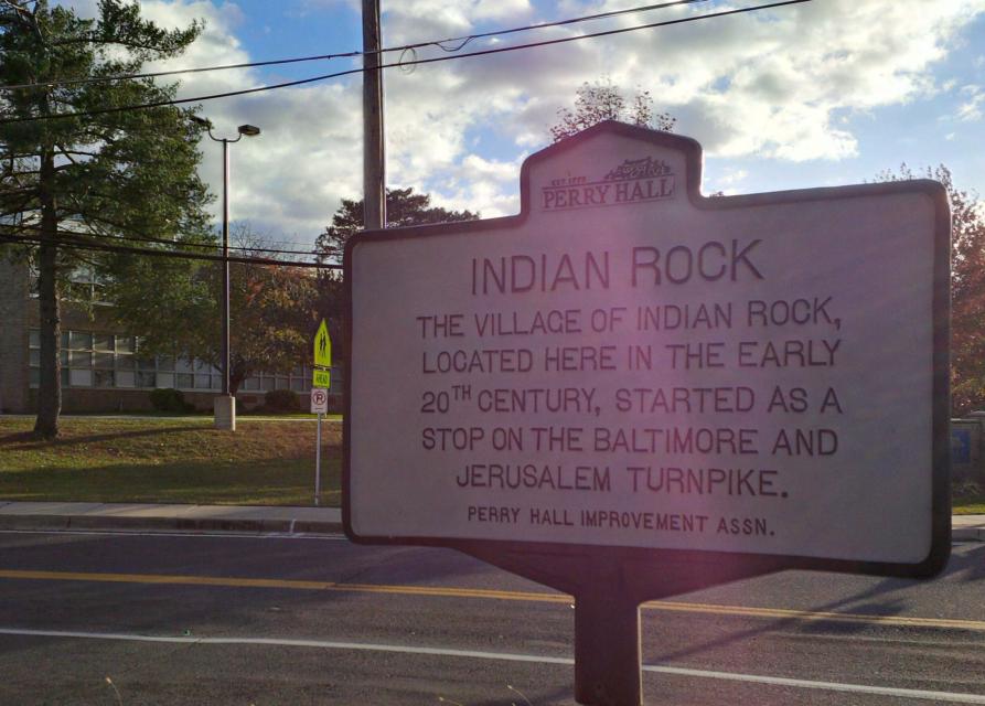
Inscription
The village of Indian Rock, located here in the early 20th Century, started as a stop on the Baltimore and Jerusalem Turnpike.
Details
| HM Number | HMG9L |
|---|---|
| Tags | |
| Historical Period | 20th Century |
| Historical Place | Town |
| Marker Type | Historic District |
| Marker Class | Historical Marker |
| Marker Style | Free Standing |
| Year Placed | 2009 |
| Placed By | Perry Hall Improvement Association |
| Marker Condition | No reports yet |
| Date Added | Thursday, September 25th, 2014 at 6:15am PDT -07:00 |
Pictures

Locationbig map
| UTM (WGS84 Datum) | 18S E 372748 N 4362230 |
|---|---|
| Decimal Degrees | 39.40020000, -76.47788333 |
| Degrees and Decimal Minutes | N 39° 24.012', W 76° 28.673' |
| Degrees, Minutes and Seconds | 39° 24' 0.7200" N, 76° 28' 40.3800" W |
| Driving Directions | Google Maps |
| Area Code(s) | 410, 443 |
| Can be seen from road? | Yes |
| Is marker in the median? | No |
| Which side of the road? | Marker is on the right when traveling West |
| Closest Postal Address | At or near 4205 E Joppa Rd, Nottingham MD 21236, US |
| Alternative Maps | Google Maps, MapQuest, Bing Maps, Yahoo Maps, MSR Maps, OpenCycleMap, MyTopo Maps, OpenStreetMap |
Is this marker missing? Are the coordinates wrong? Do you have additional information that you would like to share with us? If so, check in.
Nearby Markersshow on map
Show me all markers in: Nottingham, MD | Baltimore County | 21236 | Maryland | United States of America
Maintenance Issues
- Is this marker part of a series?
Comments 0 comments