Inscription
A Signalman's Lot
— Antietam Campaign 1862 —
You are at the foot of Sugarloaf Mountain, where on September 5-6, 1862, Union observers watched the Army of Northern Virginia cross the Potomac River to invade Maryland. A signal station had been established here in the summer of 1861, one in a chain of such stations. It communicated with a signal station and U.S. Signal Corps school southeast of Darnestown, from which messages were relayed to Washington, and with the Point of Rocks railhead of the Baltimore and Ohio Railroad to the northwest, where messages would be passed to Harpers Ferry. The signals were made by holding a flag in various positions, representing letters, and sometimes in code.On September 5, 1862, only Lt. Brinkerhoff "Brink" Miner and his aide Pvt. A.H. Cook manned the signal station. After signaling the invasion of the Confederate army to Darnestown and Point of Rocks, they made a hasty retreat down the mountain but decided to return the next morning. They ran headfirst into the 1st North Carolina Cavalry and took advantage of mutual surprise to turn around and escape, capturing a Confederate courier who had ridden out ahead of the troopers.
Later, the Confederates caught up with the group four miles toward Urbana at the home of a young woman friend of Miner. As they were dragged outside and searched, Gen. J.E.B. Stuart rode up and told the Federal prisoners, "Good morning, gentlemen. I am very happy to see you." Miner replied, "Good morning, General, we are sorry we cannot return the compliment."
(Sidebar) Quarters were probably located below the summit on the west side near where a small stone fort (constructed in the 1930s) is located today. The station itself was located below the stone fort where the road to the summit meets the loop road at a circle.
Details
| HM Number | HMH1 |
|---|---|
| Series | This marker is part of the Maryland Civil War Trails series |
| Tags | |
| Placed By | Maryland Civl War Trails |
| Marker Condition | No reports yet |
| Date Added | Sunday, August 31st, 2014 at 5:38pm PDT -07:00 |
Pictures
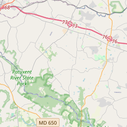
Locationbig map


| UTM (WGS84 Datum) | 18S E 293478 N 4347431 |
|---|---|
| Decimal Degrees | 39.25163333, -77.39336667 |
| Degrees and Decimal Minutes | N 39° 15.098', W 77° 23.602' |
| Degrees, Minutes and Seconds | 39° 15' 5.88" N, 77° 23' 36.12" W |
| Driving Directions | Google Maps |
| Area Code(s) | 301 |
| Closest Postal Address | At or near 1201 Sugarloaf Mountain Rd, Dickerson MD 20842, US |
| Alternative Maps | Google Maps, MapQuest, Bing Maps, Yahoo Maps, MSR Maps, OpenCycleMap, MyTopo Maps, OpenStreetMap |
Is this marker missing? Are the coordinates wrong? Do you have additional information that you would like to share with us? If so, check in.
Nearby Markersshow on map
Maintenance Issues
- What historical period does the marker represent?
- What historical place does the marker represent?
- What type of marker is it?
- What class is the marker?
- What style is the marker?
- Does the marker have a number?
- What year was the marker erected?
- This marker needs at least one picture.
- Can this marker be seen from the road?
- Is the marker in the median?

Comments 0 comments