Inscription
Major General George A. Custer
1839-1876
Distinguished soldier from the state of Michigan was graduated from U.S. Military Academy 1861
He, with 264 officers and men of the Seventh U.S. Calvary, was killed in action at the Battle of the Little Big Horn, Montana Territory, 25 June 1876.
Details
| HM Number | HMHSD |
|---|---|
| Tags | |
| Year Placed | 1969 |
| Placed By | U.S. Army |
| Marker Condition | No reports yet |
| Date Added | Monday, October 6th, 2014 at 9:57pm PDT -07:00 |
Pictures
Locationbig map

| UTM (WGS84 Datum) | 17T E 303501 N 4694909 |
|---|---|
| Decimal Degrees | 42.38163333, -83.38691667 |
| Degrees and Decimal Minutes | N 42° 22.898', W 83° 23.215' |
| Degrees, Minutes and Seconds | 42° 22' 53.88" N, 83° 23' 12.90" W |
| Driving Directions | Google Maps |
| Area Code(s) | 248, 313, 734 |
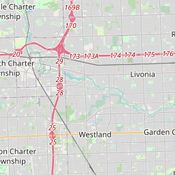
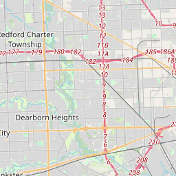
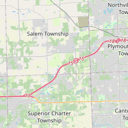
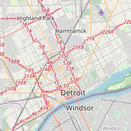
| Closest Postal Address | At or near 34657-34999 Schoolcraft Rd, Livonia MI 48150, US |
| Alternative Maps | Google Maps, MapQuest, Bing Maps, Yahoo Maps, MSR Maps, OpenCycleMap, MyTopo Maps, OpenStreetMap |
Is this marker missing? Are the coordinates wrong? Do you have additional information that you would like to share with us? If so, check in.
Nearby Markersshow on map
Maintenance Issues
- Is this marker part of a series?
- What historical period does the marker represent?
- What historical place does the marker represent?
- What type of marker is it?
- What class is the marker?
- What style is the marker?
- Does the marker have a number?
- This marker needs at least one picture.
- Can this marker be seen from the road?
- Is the marker in the median?
Comments 0 comments