Inscription
February 1781
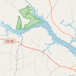
You are looking toward a site of American Patriot General Nathanael Greene's strategic "Retreat to the Dan" which occurred on February 14, 1781. This retreat foiled British General Cornwallis's southern strategy and was a turning point in the American victory.The Crossing of the Dan took place at Boyd's Ferry and Irvine's Ferry. Boyd's Ferry is just past the railroad trestle. The site of Irvine's Ferry is four miles upstream.
General Cornwallis commanded an army of seasoned British soldiers in pursuit of General Greene's smaller force. Cornwallis hoped to overtake the American army in North Carolina, thus setting the stage for the capture of Virginia and a certain victory for England.
Realizing they were unprepared to face the British, the American army traveled from Guilford Courthouse, North Carolina (now Greensboro) for four days to reach the Dan River. Greene, who had been George Washington's quartermaster, was aware of the necessity of recruits, supplies, and a surprise maneuver to outwit the enemy.
To the rear of the slower foot soldiers, Greene assigned a Light Troop cavalry under Col. Otha Williams and Lt. Col. Henry "Lighthorse Harry" Lee (father of General Robert E. Lee). This Light Troop led the British cavalry on a series of false leads. This cavalry chase gave the Americans time to get their slowest units to the crossing site ahead of the British. These units would be safe from British attack once they crossed to the north side of the river.
Boats were at the ferry landings. These boats and their crews were called into service by Col. Edward Carrington, General Greene's quartermaster. All of the Americans made a safe crossing of the icy, rain-swollen Dan River before the British could catch up. On February 14, 1781, Lighthorse Harry Lee and Edward Carrington were in the last boat to cross to the north side of the river. The stranded British could find no vessels of any kind. Any effort to swim or ford the river would have been met with Patriot resistance. General Cornwallis had been tricked. He had been led far away from his lines of support and communication. His army turned away from the Dan and marched back to North Carolina.
The results of the retreat to the Dan were dramatic. Greene more than doubled his troops in a few weeks. Seeing the enemy on their own property caused many people to join the Patriot army. Also, Greene found much needed supplies in Halifax County. In March, Greene led his increased forces in the Battle of Guilford Courthouse. He inflicted heavy losses on the Redcoats of Lord Cornwallis although the British claimed victory by holding the field.
Cornwallis withdrew to Wilmington, NC, for supplies and replacement troops, but the Crossing of the Dan and other factors forced him to camp at Yorktown rather than to sweep through Virginia for a British victory. Cornwallis was trapped when the French fleet held off a British squadron nearby in the Atlantic and when American General George Washington and French General Comte de Rochambeau combined forces on land to bring about England's defeat. British surrender on October 19, 1781, signaled the end of the American Revolution. Without Greene's Retreat to the Dan, the surrender at Yorktown would never have taken place.
The Retreat to the Dan is often overlooked for more dramatic and bloody battlefields. The citizens of Halifax County are proud that their ancestors had a part in a turning point in the war which was accomplished with strategy rather than bloodshed.
Given in honor of Mr. Carroll Headspeth
Details
| HM Number | HMKP7 |
|---|---|
| Series | This marker is part of the Daughters of the American Revolution series |
| Tags | |
| Year Placed | 1999 |
| Placed By | The Berryman Green Chapter of the Daughters of the American Revolution |
| Marker Condition | No reports yet |
| Date Added | Wednesday, October 15th, 2014 at 9:19pm PDT -07:00 |
Pictures
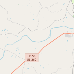
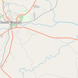
Locationbig map


| UTM (WGS84 Datum) | 17S E 687640 N 4063212 |
|---|---|
| Decimal Degrees | 36.69606667, -78.89958333 |
| Degrees and Decimal Minutes | N 36° 41.764', W 78° 53.975' |
| Degrees, Minutes and Seconds | 36° 41' 45.84" N, 78° 53' 58.50" W |
| Driving Directions | Google Maps |
| Area Code(s) | 434 |
| Closest Postal Address | At or near 106-108 Wren St, South Boston VA 24592, US |
| Alternative Maps | Google Maps, MapQuest, Bing Maps, Yahoo Maps, MSR Maps, OpenCycleMap, MyTopo Maps, OpenStreetMap |
Is this marker missing? Are the coordinates wrong? Do you have additional information that you would like to share with us? If so, check in.
Nearby Markersshow on map
Show me all markers in: South Boston, VA | Halifax County | 24592 | Virginia | United States of America
Maintenance Issues
- What historical period does the marker represent?
- What historical place does the marker represent?
- What type of marker is it?
- What class is the marker?
- What style is the marker?
- Does the marker have a number?
- This marker needs at least one picture.
- Can this marker be seen from the road?
- Is the marker in the median?
Comments 0 comments