Inscription
A "Timbered Turnpike"
The Boydton and Petersburg Plank Road, built between 1851 and 1853, was the first all-weather route connecting Southside Virginia's tobacco and wheat farms with the market. Pine and oak planks, 8 feet long, 1 foot wide, and 3-4 inches thick were laid across paralleled beams slanting toward a ditch. The road boosted crop revenues 30 to 100 percent. Along the approximately 73 miles, there were 7 toll houses and keepers. Stagecoaches drove the 73 miles Monday through Saturday, stopping every 11 miles for food and fresh teams. Condemned by 1860, the victim of heat, rainfall, humidity, and clay, it nonetheless provided an important route for troop movements during the Civil War. Another continuous hard-surface link would not exist until the 1930s. Parts of some highways, including U.S. 1, follow the old roadbed, and Petersburg still has a thoroughfare called Boydton Plank Road. A ten mile extension to the Roanoke River at Clarksville was completed in 1856.Details
| HM Number | HMLAM |
|---|---|
| Tags | |
| Marker Condition | No reports yet |
| Date Added | Sunday, October 26th, 2014 at 10:02pm PDT -07:00 |
Pictures
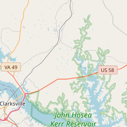
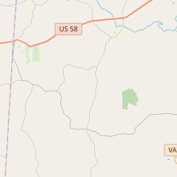
Locationbig map

| UTM (WGS84 Datum) | 17S E 733649 N 4061315 |
|---|---|
| Decimal Degrees | 36.66878333, -78.38558333 |
| Degrees and Decimal Minutes | N 36° 40.127', W 78° 23.135' |
| Degrees, Minutes and Seconds | 36° 40' 7.62" N, 78° 23' 8.10" W |
| Driving Directions | Google Maps |
| Area Code(s) | 434 |
| Closest Postal Address | At or near 177-299 State Rte T-1204, Boydton VA 23917, US |
| Alternative Maps | Google Maps, MapQuest, Bing Maps, Yahoo Maps, MSR Maps, OpenCycleMap, MyTopo Maps, OpenStreetMap |
Is this marker missing? Are the coordinates wrong? Do you have additional information that you would like to share with us? If so, check in.
Nearby Markersshow on map
Show me all markers in: Boydton, VA | Mecklenburg County | 23917 | Virginia | United States of America
Maintenance Issues
- Is this marker part of a series?
- What historical period does the marker represent?
- What historical place does the marker represent?
- What type of marker is it?
- What class is the marker?
- What style is the marker?
- Does the marker have a number?
- What year was the marker erected?
- Who or what organization placed the marker?
- This marker needs at least one picture.
- Can this marker be seen from the road?
- Is the marker in the median?
Comments 0 comments