Inscription
Historic New York
The valleys of the Upper Susquehanna River were natural routes for Indians, traders and settlers. Oquaga, near Windsor, was an Indian fur-trading post, and became an objective of the Sullivan-Clinton Campaign of 1779. From a dam at the outlet of Otsego Lake, flood waters were released to float General James Clinton's troops down the river to join General Sullivan's forces from Pennsylvania at Tioga. They defeated the Tories and Indians at Newtown, near Elmira, and devastated the Indian settlements of western New York, thus securing this area for the United States. In 1785 an Indian treaty opened this region for settlement.Many settlers of the Southern Tier counties of New York came from Pennsylvania. A Philadelphia merchant and landholder, William Bingham, gave his name to the city of Binghamton. In 1837 the Chenango canal connected the Erie Canal with the Pennsylvania coal regions, and in 1848 the Erie Railroad opened communication with metropolitan New York, and later through to the Great Lakes. Important manufactures have included cigars, shoes, leather goods, photographic materials and business machines.
Details
| HM Number | HMNIB |
|---|---|
| Series | This marker is part of the New York: Historic New York series |
| Tags | |
| Year Placed | 1961 |
| Placed By | State of New York, Education Department, Department of Public Works |
| Marker Condition | No reports yet |
| Date Added | Friday, October 3rd, 2014 at 1:41am PDT -07:00 |
Pictures
Locationbig map


| UTM (WGS84 Datum) | 18T E 435422 N 4652316 |
|---|---|
| Decimal Degrees | 42.02023333, -75.78000000 |
| Degrees and Decimal Minutes | N 42° 1.214', W 75° 46.8' |
| Degrees, Minutes and Seconds | 42° 1' 12.84" N, 75° 46' 48.00" W |
| Driving Directions | Google Maps |
| Area Code(s) | 607 |
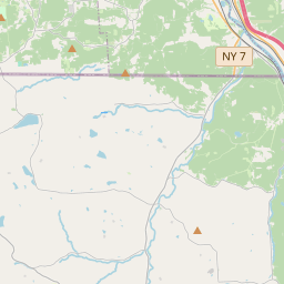
| Closest Postal Address | At or near 2049 US-11, Kirkwood NY 13795, US |
| Alternative Maps | Google Maps, MapQuest, Bing Maps, Yahoo Maps, MSR Maps, OpenCycleMap, MyTopo Maps, OpenStreetMap |
Is this marker missing? Are the coordinates wrong? Do you have additional information that you would like to share with us? If so, check in.
Nearby Markersshow on map
Pennsylvania
Citizen Soldiers from Bravo Company, First Battalion, One Hundred and Ninth Mechanized Infantry, a War Memorial
War Memorial
"Lokies" boost coal production ...
Joseph Smith
Windsor
Routes of the Armies of General John Sullivan and General James Clinton
Phelps Mansion Museum
William J. McGowan Award
Centenary Church
Maintenance Issues
- What historical period does the marker represent?
- What historical place does the marker represent?
- What type of marker is it?
- What class is the marker?
- What style is the marker?
- Does the marker have a number?
- This marker needs at least one picture.
- Can this marker be seen from the road?
- Is the marker in the median?
Comments 0 comments