Inscription
Berkeley History
— 1926 —
Berkeley's original shoreline was about where Second Street and the eastern side of Aquatic Park are located today. In 1853 a private wharf was built at the foot of what is now Delaware Street, and a working waterfront with factories and piers developed along the shoreline later in the century.This pier, constructed by the Golden Gate Ferry Company under a 1926 franchise from the City, now extends from the Berkeley Marina, which was built on landfill out into the Bay well beyond the original shoreline. It is a reminder of the earliest urban settlement in Berkeley and a time when goods and people were transported mainly by water. The pier accommodated ferries that carried cars across San Francisco Bay. After big events in Berkeley, such as football games at the University of California, hundreds of cars would back up for hours waiting to board the ferry back to San Francisco. After the Bay Bridge was completed and opened to automobile traffic in 1936 the pier was converted to recreational use, including fishing. Approximately 3,000 feet of the original 3.5 mile length of the pier remain in usable condition.
Berkeley Historical Plaque Project
2003
Details
| HM Number | HMODK |
|---|---|
| Tags | |
| Year Placed | 2003 |
| Placed By | Berkeley Historical Plaque Project |
| Marker Condition | No reports yet |
| Date Added | Sunday, September 21st, 2014 at 7:50pm PDT -07:00 |
Pictures
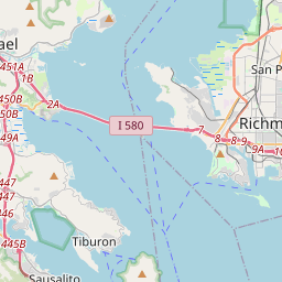
Locationbig map

| UTM (WGS84 Datum) | 10S E 560035 N 4190804 |
|---|---|
| Decimal Degrees | 37.86273333, -122.31748333 |
| Degrees and Decimal Minutes | N 37° 51.764', W 122° 19.049' |
| Degrees, Minutes and Seconds | 37° 51' 45.84" N, 122° 19' 2.94" W |
| Driving Directions | Google Maps |
| Area Code(s) | 510, 650, 408, 925 |
| Closest Postal Address | At or near 636 Berkeley Pier, Berkeley CA 94710, US |
| Alternative Maps | Google Maps, MapQuest, Bing Maps, Yahoo Maps, MSR Maps, OpenCycleMap, MyTopo Maps, OpenStreetMap |
Is this marker missing? Are the coordinates wrong? Do you have additional information that you would like to share with us? If so, check in.
Nearby Markersshow on map
Show me all markers in: Berkeley, CA | Alameda County | 94710 | California | United States of America
Maintenance Issues
- Is this marker part of a series?
- What historical period does the marker represent?
- What historical place does the marker represent?
- What type of marker is it?
- What class is the marker?
- What style is the marker?
- Does the marker have a number?
- This marker needs at least one picture.
- Can this marker be seen from the road?
- Is the marker in the median?
Comments 0 comments