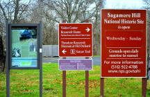
Inscription
National Park Service
Sagamore Hill was the family home of our 26th President Theodore Roosevelt, his wife Edith and their six children. He built the Queen Anne Shingle style home on 155 acres between 1884 and 1886 and it became known as the "Summer White House" during his Presidency from 1901-1909. In addition to his home, the site contained a working farm with numerous outbuildings, pastures, a garden, orchard, woodlands, a tidal marsh and a beach on Cold Spring Harbor. This "birds-eye view" depicts the site's structures and landscape features in 1918, approximately one year before Theodore Roosevelt's death. Edith Roosevelt remained in the family home and managed the farm until her death in 1948." . . . fond as I am of the White House . . . there isn't any place in the world like home - like Sagamore Hill, where things are our own . . . and where it is real country." - Theodore Roosevelt to his daughter Ethel, June 11, 1906
[ Sidebar: ]
Visitor Attractions
1. ? Theodore Roosevelt Home - take a guided tour through the twenty-three rooms of one of the best-preserved presidential homes in America.
11. ? Visitor Center and Bookstore - receive park information, purchase tickets for a guided tour of the Roosevelt Home, and browse educational materials and souvenirs for sale.
16. ? Theodore Roosevelt Museum at Old Orchard - enjoy three galleries of exhibits and an audio visual presentation telling the story of TR's fascinating personal and political life.
18. ? Nature Trail to Eel Creek Saltmarsh and Oyster Bay National Wildlife Refuge - experience a .7 mile loop trail on an unspoiled section of North Shore coastline.
Details
| HM Number | HMSQX |
|---|---|
| Tags | |
| Placed By | National Park Service |
| Marker Condition | No reports yet |
| Date Added | Wednesday, September 17th, 2014 at 4:13pm PDT -07:00 |
Pictures
Photo Credits: [1] RPELLJR25
Locationbig map
| UTM (WGS84 Datum) | 18T E 626450 N 4527221 |
|---|---|
| Decimal Degrees | 40.88631667, -73.49905000 |
| Degrees and Decimal Minutes | N 40° 53.179', W 73° 29.943' |
| Degrees, Minutes and Seconds | 40° 53' 10.74" N, 73° 29' 56.58" W |
| Driving Directions | Google Maps |
| Area Code(s) | 631, 516 |
| Closest Postal Address | At or near 304 Sagamore Hill Rd, Oyster Bay NY 11771, US |
| Alternative Maps | Google Maps, MapQuest, Bing Maps, Yahoo Maps, MSR Maps, OpenCycleMap, MyTopo Maps, OpenStreetMap |
Is this marker missing? Are the coordinates wrong? Do you have additional information that you would like to share with us? If so, check in.
Nearby Markersshow on map
Maintenance Issues
- Is this marker part of a series?
- What historical period does the marker represent?
- What historical place does the marker represent?
- What type of marker is it?
- What class is the marker?
- What style is the marker?
- Does the marker have a number?
- What year was the marker erected?
- This marker could use another picture or two.
- Can this marker be seen from the road?
- Is the marker in the median?

Comments 0 comments