Inscription
In 1907, Alfred Swann and Eugene Holtsinger constructed the original section of seawall and roadway extending from Swann Avenue to Rome Avenue. This initial section, which was called Bayshore Drive, served Suburb Beautiful, the first residential development along the bayshore. Subsequently, as a result of a 1912 bond issue, 2.3 miles of seawall and roadway were added by Hillsborough County. Thus, the bayshore was expanded to 3.2 miles, transforming the original drive to Bayshore Boulevard.
?????The Great Hurricane of 1921 destroyed a substantial portion of the boulevard, resulting in a 1925 reconstruction project. The City of Tampa reconstructed the boulevard within the city limits. Concurrently, Hillsborough County built a new section of boulevard extending from Hawthorne Road to Howard Avenue.
?????In 1935, the Works Progress Administration (WPA) provided the resources necessary to once again reconstruct the Bayshore Boulevard as well as build the Bayshore Boat Docks, presently known as the Bayshore Marina. This 1935 project resulted in a wider Bayshore Boulevard extending from Hawthorne Road to the Platt Street Bridge.
?????Since 1935, time and storms have taken a toll upon the Bayshore Boulevard. In 1992, under the direction of Mayor Sandra Warshaw Freedman, the Bayshore Boulevard restoration project was completed, resulting in the restoration of the seawall system as well as the realignment of the northbound roadway between Hawthorne Road and Rome Avenue. Thus, Bayshore Boulevard has evolved not only to serve vehicular traffic but also provide a recreational linear green space along four miles of uninterrupted waterfront sidewalk.
Details
| HM Number | HMTZS |
|---|---|
| Series | This marker is part of the Works Progress Administration (WPA) projects series |
| Tags | |
| Placed By | The City of Tampa |
| Marker Condition | No reports yet |
| Date Added | Sunday, September 14th, 2014 at 3:05am PDT -07:00 |
Pictures
Locationbig map


| UTM (WGS84 Datum) | 17R E 356439 N 3091567 |
|---|---|
| Decimal Degrees | 27.94140000, -82.45921667 |
| Degrees and Decimal Minutes | N 27° 56.484', W 82° 27.553' |
| Degrees, Minutes and Seconds | 27° 56' 29.04" N, 82° 27' 33.18" W |
| Driving Directions | Google Maps |
| Area Code(s) | 813 |
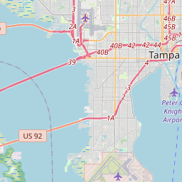
| Closest Postal Address | At or near 300-302 Bayshore Blvd, Tampa FL 33606, US |
| Alternative Maps | Google Maps, MapQuest, Bing Maps, Yahoo Maps, MSR Maps, OpenCycleMap, MyTopo Maps, OpenStreetMap |
Is this marker missing? Are the coordinates wrong? Do you have additional information that you would like to share with us? If so, check in.
Nearby Markersshow on map
Show me all markers in: Tampa, FL | Hillsborough County | 33606 | Florida | United States of America
Maintenance Issues
- What historical period does the marker represent?
- What historical place does the marker represent?
- What type of marker is it?
- What class is the marker?
- What style is the marker?
- Does the marker have a number?
- What year was the marker erected?
- This marker needs at least one picture.
- Can this marker be seen from the road?
- Is the marker in the median?
Comments 0 comments