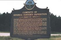
August 1 - 6, 1874
This picturesque valley was the site of the permanent camp of the Black Hills Expedition of 1874 under the command of General George A. Custer of the 7th Cavalry. Their 5 day stay was the longest stop made during the entire expedition and General Custer used this campsite as a base for reconnaissance trips to other points in the Black Hills.The expedition party totaled about 1000 men, 1900 horses and mules, 300 beef cattle and 110 wagons. In addition to the cavalry, the personnel included nearly 100 Indian scouts, guides, interpreters, engineers, newspaper correspondents, two practical miners, and a photographer. This is said to have been the largest and best equipped expedition ever assembled, up to that time, for military exploration duty in the Northwest. The entire valley was scattered with their tents and wagons during their stay.
Gold was first discovered in French Creek, which runs through the valley, by Horatio N. Ross. This discovery of gold led to the first Miners' Organization in the Black Hills which formed around a campfire on August 5, 1874. Because of the discovery of gold here, General Custer gave to this place the name of "Golden Valley."
General Custer sent a scout messenger out from this camp to carry the word to Ft. Laramie that gold had been discovered on French Creek. This caused a stampede over the country to force entrance into these forbidden Back Hills. Late in December 1874, the first settlers, the Collins-Russell party, under the guidance of John Gordon, reached this site. Thousands of gold seekers soon followed.
| HM Number | HMUHY |
|---|---|
| Tags | |
| Year Placed | 1971 |
| Placed By | Custer Co. Hist. Soc., State Hist. Soc., and State Highway Dept |
| Marker Condition | No reports yet |
| Date Added | Thursday, September 11th, 2014 at 11:58am PDT -07:00 |
| UTM (WGS84 Datum) | 13T E 617634 N 4847395 |
|---|---|
| Decimal Degrees | 43.77026667, -103.53840000 |
| Degrees and Decimal Minutes | N 43° 46.216', W 103° 32.304' |
| Degrees, Minutes and Seconds | 43° 46' 12.96" N, 103° 32' 18.24" W |
| Driving Directions | Google Maps |
| Area Code(s) | 605 |
| Closest Postal Address | At or near 1350-1390 Stockade Lake Dr, Custer SD 57730, US |
| Alternative Maps | Google Maps, MapQuest, Bing Maps, Yahoo Maps, MSR Maps, OpenCycleMap, MyTopo Maps, OpenStreetMap |
Is this marker missing? Are the coordinates wrong? Do you have additional information that you would like to share with us? If so, check in.
- Is this marker part of a series?
- What historical period does the marker represent?
- What historical place does the marker represent?
- What type of marker is it?
- What class is the marker?
- What style is the marker?
- Does the marker have a number?
- This marker could use another picture or two.
- Can this marker be seen from the road?
- Is the marker in the median?


Comments 0 comments