Inscription
As you drive up Pikes Peak, you'll feel it get colder. You'll also notice that the plants change. See if you can pick out four different life zones on the way to and from the summit.
A life zone is a plant and animal community that exists at a certain elevational range. The Life Zones of Pikes Peak. Going up 1000 feet in elevation is like traveling 600 miles to the north. Alpine, 11,500 ft. and above. Subalpine, 9,500-11,000 feet. Montane, 8,000-9,500 feet. Foothills, 6,000-8,000 feet. Plains, 6,000 feet and under.
For every 1,000 foot rise in elevation the average temperature drops 3 degrees F. Precipitation also increases as you go up in elevation. Winds buffet the top of the peak and the frost-free season is reduced to 1 ½ months.
Watch for these different plants and animals that do best each climactic zone: Narrow-leaved grasses and burrowing animals are adapted to the dry Plains life zone. Scrub oaks, black bears and mule deer characterize the Foothills life zone. Aspens and elk thrive in the lush Montane zone. Spire-like Englemann spruce and snowshoe hares are adapted to the snowy Subalpine zone. Low-growing tundra flowers and short-tailed weasels survive in the wintery Alpine life zone.
Details
| HM Number | HMUW9 |
|---|---|
| Tags | |
| Marker Condition | No reports yet |
| Date Added | Saturday, October 4th, 2014 at 12:43pm PDT -07:00 |
Pictures
Locationbig map
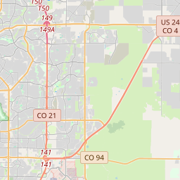


| UTM (WGS84 Datum) | 13S E 497762 N 4308086 |
|---|---|
| Decimal Degrees | 38.92168333, -105.02581667 |
| Degrees and Decimal Minutes | N 38° 55.301', W 105° 1.549' |
| Degrees, Minutes and Seconds | 38° 55' 18.06" N, 105° 1' 32.94" W |
| Driving Directions | Google Maps |
| Area Code(s) | 719 |
| Closest Postal Address | At or near 125-199 Pikes Peak Toll Rd, Versailles CO 80809, US |
| Alternative Maps | Google Maps, MapQuest, Bing Maps, Yahoo Maps, MSR Maps, OpenCycleMap, MyTopo Maps, OpenStreetMap |
Is this marker missing? Are the coordinates wrong? Do you have additional information that you would like to share with us? If so, check in.
Nearby Markersshow on map
Show me all markers in: Versailles, CO | Ripley County | 80809 | Colorado | United States of America
Maintenance Issues
- Is this marker part of a series?
- What historical period does the marker represent?
- What historical place does the marker represent?
- What type of marker is it?
- What class is the marker?
- What style is the marker?
- Does the marker have a number?
- What year was the marker erected?
- Who or what organization placed the marker?
- This marker needs at least one picture.
- Can this marker be seen from the road?
- Is the marker in the median?
Comments 0 comments