Inscription
Memorial in honor of
Col. Joshua Fry
Born c. 1700 in England
1731 · Professor of mathematics at William and Mary College, Planter in Albemarle County, Virginia, Member of House of Burgesses, First presiding judge of Albemarle County, Commander of militia, Surveyor
1746-51 · Col. Fry and Peter Jefferson surveyed and produced first map of Virginia.
1752 · Joshua Fry, Lunsford Lomax and James Patton were chosen to make a treaty with the Six Nations at Logstown (Lancaster)which permitted the English to build two forts on the Ohio and to settle southeast of that river.
1754 · During the French and Indian War, Col Fry was commissioned by the governor of Virginia to lead an expedition to build an outpost on the Ohio River. On his way with 300 men to complete this mission, he was thrown from his horse on what is now called Break Neck Rd. near Fort Cumberland, Maryland, and died at the fort on May 31, 1754. He was buried between the fort and Wills Creek. The command of the expedition fell to 22 year-old George Washington.
Details
| HM Number | HM10JK |
|---|---|
| Tags | |
| Marker Condition | No reports yet |
| Date Added | Monday, October 20th, 2014 at 1:48am PDT -07:00 |
Pictures
Locationbig map
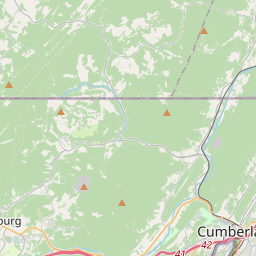
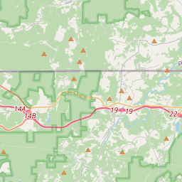

| UTM (WGS84 Datum) | 17S E 691777 N 4391242 |
|---|---|
| Decimal Degrees | 39.64948333, -78.76480000 |
| Degrees and Decimal Minutes | N 39° 38.969', W 78° 45.888' |
| Degrees, Minutes and Seconds | 39° 38' 58.14" N, 78° 45' 53.28" W |
| Driving Directions | Google Maps |
| Area Code(s) | 301, 240 |
| Closest Postal Address | At or near 700-754 Bridge St, Cumberland MD 21502, US |
| Alternative Maps | Google Maps, MapQuest, Bing Maps, Yahoo Maps, MSR Maps, OpenCycleMap, MyTopo Maps, OpenStreetMap |
Is this marker missing? Are the coordinates wrong? Do you have additional information that you would like to share with us? If so, check in.
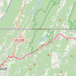
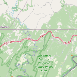
Nearby Markersshow on map
Show me all markers in: Cumberland, MD | Allegany County | 21502 | Maryland | United States of America
Maintenance Issues
- Is this marker part of a series?
- What historical period does the marker represent?
- What historical place does the marker represent?
- What type of marker is it?
- What class is the marker?
- What style is the marker?
- Does the marker have a number?
- What year was the marker erected?
- Who or what organization placed the marker?
- This marker needs at least one picture.
- Can this marker be seen from the road?
- Is the marker in the median?
Comments 0 comments