Inscription
Land for this park was donated to the city in 1893. The park formerly included the site of the bridge approached to your right and an area extending along the river bank upstream. Then, there were extensive walkways, benches, flowerbeds, a viewing fountain, a boat dock, and a bandstand. Concerts were given during the summer on Sundays. The park was a focal point of activity. Excursion boats operated up the Potomac River from the park until 1924. The boats were operated by Frederick "Buck" Dreyer and provided pleasant rides and access to Dreyer's Beach (upriver near Bowling Green) for swimming.
Riverside Park presently is part of the Fort Cumberland Trail. Herein are found many historical markers and exhibits commemorating our local heritage. These include the cabin (now restored) which served as a headquarters of Colonel George Washington during the French and Indian War period and a stone marker which honors Colonel Thomas Cresap and his family.
Riverside Park presently is part of the Fort Cumberland Trail. Herein are found many historical markers and exhibits commemorating our local heritage. These include the cabin (now restored) which served as a headquarters of Colonel George Washington during the French and Indian War period and a stone marker which honors Colonel Thomas Cresap and his family.
Details
| HM Number | HMBL8 |
|---|---|
| Tags | |
| Marker Condition | No reports yet |
| Date Added | Tuesday, October 14th, 2014 at 3:16pm PDT -07:00 |
Pictures
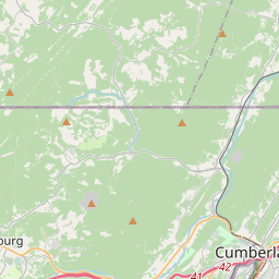
Locationbig map

| UTM (WGS84 Datum) | 17S E 691773 N 4391271 |
|---|---|
| Decimal Degrees | 39.64975000, -78.76483333 |
| Degrees and Decimal Minutes | N 39° 38.985', W 78° 45.89' |
| Degrees, Minutes and Seconds | 39° 38' 59.10" N, 78° 45' 53.40" W |
| Driving Directions | Google Maps |
| Area Code(s) | 301, 240 |
| Closest Postal Address | At or near 36 Greene St, Cumberland MD 21502, US |
| Alternative Maps | Google Maps, MapQuest, Bing Maps, Yahoo Maps, MSR Maps, OpenCycleMap, MyTopo Maps, OpenStreetMap |
Is this marker missing? Are the coordinates wrong? Do you have additional information that you would like to share with us? If so, check in.
Nearby Markersshow on map
Show me all markers in: Cumberland, MD | Allegany County | 21502 | Maryland | United States of America
Maintenance Issues
- Is this marker part of a series?
- What historical period does the marker represent?
- What historical place does the marker represent?
- What type of marker is it?
- What class is the marker?
- What style is the marker?
- Does the marker have a number?
- What year was the marker erected?
- Who or what organization placed the marker?
- This marker needs at least one picture.
- Can this marker be seen from the road?
- Is the marker in the median?
Comments 0 comments