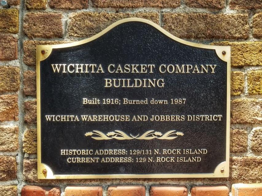
Inscription
Built 1916; Burned down 1987
— Wichita Warehouse and Jobbers District —
Current Address: 129 N. Rock Island
Details
| HM Number | HM1290 |
|---|---|
| Tags | |
| Marker Condition |  9 out of 10 (1 reports) |
| Date Added | Thursday, September 4th, 2014 at 5:28am PDT -07:00 |
Pictures
Locationbig map
| UTM (WGS84 Datum) | 14S E 647401 N 4172419 |
|---|---|
| Decimal Degrees | 37.68715000, -97.32825000 |
| Degrees and Decimal Minutes | N 37° 41.229', W 97° 19.695' |
| Degrees, Minutes and Seconds | 37° 41' 13.74" N, 97° 19' 41.70" W |
| Driving Directions | Google Maps |
| Area Code(s) | 316 |
| Closest Postal Address | At or near 129 N Rock Island, Wichita KS 67202, US |
| Alternative Maps | Google Maps, MapQuest, Bing Maps, Yahoo Maps, MSR Maps, OpenCycleMap, MyTopo Maps, OpenStreetMap |
Is this marker missing? Are the coordinates wrong? Do you have additional information that you would like to share with us? If so, check in.
Nearby Markersshow on map
Maintenance Issues
- Is this marker part of a series?
- What historical period does the marker represent?
- What historical place does the marker represent?
- What type of marker is it?
- What class is the marker?
- What style is the marker?
- Does the marker have a number?
- What year was the marker erected?
- Who or what organization placed the marker?
- This marker could use another picture or two.
- Can this marker be seen from the road?
- Is the marker in the median?
Comments 0 comments