Inscription
A Town becomes a City
Frederick Town was founded in 1745 when Daniel Dulany the Elder carved out an eastern portion of his 7,000 acre parcel patented as "Tasker's Chance." The town was then laid out in an orderly grid with Patrick Street designated as the east-west thoroughfare and Market Street running north-south. Most agree that the first house in town was built at the northeast corner of Patrick Street and Maxwell Alley by schoolteacher John Thomas Schley in 1746. National Road mile stone 45 now stands in front of the Schley house site.Frederick Town prospered from the start. It became the seat of government when Frederick County was established in 1748. By 1800 it had 2,600 residents in 450 houses. Soon after, the Baltimore and Frederick-Town Turnpike, the first leg of the new National Road, arrived. During the next few decades, millions of travelers passed through Frederick which, by 1817, dropped the "Town" as it became a more respectable city.
Details
| HM Number | HM17W |
|---|---|
| Series | This marker is part of the The Historic National Road series |
| Tags | |
| Placed By | America's ByWays |
| Marker Condition | No reports yet |
| Date Added | Thursday, October 9th, 2014 at 4:14am PDT -07:00 |
Pictures
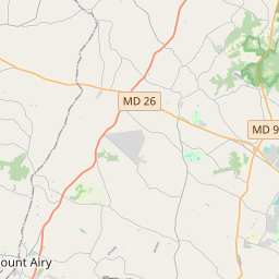
Locationbig map


| UTM (WGS84 Datum) | 18S E 292599 N 4365495 |
|---|---|
| Decimal Degrees | 39.41405000, -77.40911667 |
| Degrees and Decimal Minutes | N 39° 24.843', W 77° 24.547' |
| Degrees, Minutes and Seconds | 39° 24' 50.58" N, 77° 24' 32.82" W |
| Driving Directions | Google Maps |
| Area Code(s) | 301, 410, 240 |
| Closest Postal Address | At or near 98 MD-144, Frederick MD 21701, US |
| Alternative Maps | Google Maps, MapQuest, Bing Maps, Yahoo Maps, MSR Maps, OpenCycleMap, MyTopo Maps, OpenStreetMap |
Is this marker missing? Are the coordinates wrong? Do you have additional information that you would like to share with us? If so, check in.
Nearby Markersshow on map
Show me all markers in: Frederick, MD | Frederick County | 21701 | Maryland | United States of America
Maintenance Issues
- What historical period does the marker represent?
- What historical place does the marker represent?
- What type of marker is it?
- What class is the marker?
- What style is the marker?
- Does the marker have a number?
- What year was the marker erected?
- This marker needs at least one picture.
- Can this marker be seen from the road?
- Is the marker in the median?

Comments 0 comments