Inscription
Foiling Maryland Secession
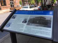
The building in front of you, Kemp Hall, was the capitol of Maryland during the spring and summer of 1861, as the state came perilously close to leaving the Union. Because secession would have placed the U.S. capital, Washington, D.C. between the Confederate states of Maryland and Virginia, President Abraham Lincoln could not let it happen.Two weeks after the Confederate capture of Fort Sumter, South Carolina, Maryland Gov. Thomas H. Hicks called the General Assembly into special session here in Frederick, a strongly Unionist city to debate secession. The state capital, Annapolis, was seething with resentment over the recent Federal occupation of that city.
Both the Senate and the House of Delegates began the session on April 26, 1861, in the former Frederick County Courthouse building located two blocks west of here. The next day, the senators and delegates moved here to Kemp Hall, a larger meeting space that belonged to the German Reformed Church.
As early as June 20, under Lincoln's suspension of the writ of habeas corpus, Federal troops began arresting suspected pro-secession legislators, starting with Delegate Ross Winans of Baltimore, who was stopped on his way home from the session here. He, like several other lawmakers, was confined briefly under Lincoln's orders.
The legislature continued to meet here at Kemp Hall throughout the summer. Finally, lacking a quorum—primarily because of the arrest of so many secession-leaning senators and delegates—it adjourned in September without ever considering a secession bill.
(captions)
Abraham Lincoln
Courtesy Library of Congress
Gov. Thomas H. Hicks
Courtesy Library of Congress
Delegate Ross Winans
Courtesy Maryland Historical Society
Kemp Hall, ca. 1870 - Historical Society of Frederick County
Details
| HM Number | HM19RW |
|---|---|
| Series | This marker is part of the Maryland Civil War Trails series |
| Tags | |
| Historical Period | Civil War |
| Historical Place | Church/House of Worship, Community Center |
| Marker Type | Historic Building |
| Marker Class | Historical Marker |
| Marker Style | Free Standing |
| Placed By | Maryland Civil War Trails |
| Marker Condition | No reports yet |
| Date Added | Wednesday, October 22nd, 2014 at 1:12pm PDT -07:00 |
Pictures
Locationbig map
| UTM (WGS84 Datum) | 18S E 292465 N 4365637 |
|---|---|
| Decimal Degrees | 39.41530000, -77.41071667 |
| Degrees and Decimal Minutes | N 39° 24.918', W 77° 24.643' |
| Degrees, Minutes and Seconds | 39° 24' 55.0800" N, 77° 24' 38.5800" W |
| Driving Directions | Google Maps |
| Area Code(s) | 301, 410, 240 |
| Can be seen from road? | Yes |
| Is marker in the median? | No |
| Which side of the road? | Marker is on the right when traveling East |
| Closest Postal Address | At or near 2 E Church St, Frederick MD 21701, US |
| Alternative Maps | Google Maps, MapQuest, Bing Maps, Yahoo Maps, MSR Maps, OpenCycleMap, MyTopo Maps, OpenStreetMap |
Is this marker missing? Are the coordinates wrong? Do you have additional information that you would like to share with us? If so, check in.
Nearby Markersshow on map
Show me all markers in: Frederick, MD | Frederick County | 21701 | Maryland | United States of America
Related Markers


Comments 0 comments