Inscription
Here the Brave Men of Stonington
Defeated a Landing Force From
His Majesty's ship "Ramillies"
Bent on Burning the Town and its Shipping
August 10, 1814
The Warden and Burgesses of the
Borough of Stonington
Deeded by U.S. Govt. 1932 ? Erected 1956
Details
| HM Number | HM1AN2 |
|---|---|
| Tags | |
| Year Placed | 1956 |
| Placed By | The Warden and Burgesses of the Borough of Stonington |
| Marker Condition | No reports yet |
| Date Added | Friday, October 24th, 2014 at 11:25pm PDT -07:00 |
Pictures
Locationbig map
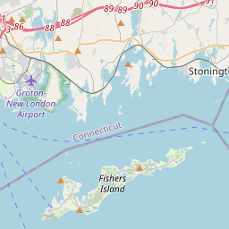
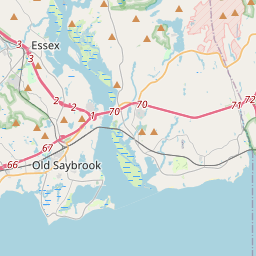

| UTM (WGS84 Datum) | 19T E 256852 N 4579168 |
|---|---|
| Decimal Degrees | 41.32733333, -71.90538333 |
| Degrees and Decimal Minutes | N 41° 19.64', W 71° 54.323' |
| Degrees, Minutes and Seconds | 41° 19' 38.40" N, 71° 54' 19.38" W |
| Driving Directions | Google Maps |
| Area Code(s) | 860 |
| Closest Postal Address | At or near 1 Water St, Stonington CT 06378, US |
| Alternative Maps | Google Maps, MapQuest, Bing Maps, Yahoo Maps, MSR Maps, OpenCycleMap, MyTopo Maps, OpenStreetMap |
Is this marker missing? Are the coordinates wrong? Do you have additional information that you would like to share with us? If so, check in.
Nearby Markersshow on map
Show me all markers in: Stonington, CT | New London County | 06378 | Connecticut | United States of America
Maintenance Issues
- Is this marker part of a series?
- What historical period does the marker represent?
- What historical place does the marker represent?
- What type of marker is it?
- What class is the marker?
- What style is the marker?
- Does the marker have a number?
- This marker needs at least one picture.
- Can this marker be seen from the road?
- Is the marker in the median?
Comments 0 comments