Inscription
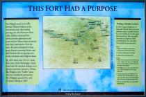
THIS FORT HAD A PURPOSE
Fort Ridgely served as a buffer between Dakota Indians on the reservations and white settlers pouring into the Minnesota River valley. Soldiers stationed here enforced treaty agreements and protected the Dakota from intrusions onto their reservations. Over the years, the army attempted to keep peace despite mounting friction and strife between the two groups over social, economic, and religious issues.
By 1854 there were 52 U.S. Army forts west of the Mississippi. Some were built for national defense or to protect economic interests. Others, like Ridgely, were "buffer" posts and not considered permanent. Fort Ridgely operated for only 14 years, closing in 1867.
Finding a Suitable Location
In 1852, Captain Napoleon J.T. Dana and Colonel Francis Lee were ordered to select a suitable location for a new military fort on the upper Minnesota River. They eventually chose this site, high on a bluff overlooking the river and valley. The site had its pros and cons:
Pros:
· Supplies and soldiers could easily be transported up the Minnesota River.
· Good boat landing at base of bluff.
· Spring nearby for drinking water.
Cons:
· While close to the reservations, the fort was, in fact, a little too far away—15 miles from the Lower Sioux Agency and 40 miles from the Upper Sioux Agency.
· Fort Ridgely was on the north side of the river, while both agencies were on the south side.
· The fort was built for peacekeeping. It was vulnerable when used for defense, as in the summer of 1862. Deep ravines flanked three sides, while the north side was open prairie.
· The site was cold, windy, and unprotected during winter.
Fort Ridgely
Details
| HM Number | HM1CM5 |
|---|---|
| Series | This marker is part of the Minnesota Historical Society series, and the Minnesota: Fort Ridgely Interpretive Series series. |
| Tags | |
| Historical Period | 19th Century |
| Historical Place | Battlefield, Fort, Military Installation, Monument, Park |
| Marker Type | Other |
| Marker Class | Neither |
| Marker Style | Free Standing |
| Placed By | Minnesota Historical Society |
| Marker Condition | No reports yet |
| Date Added | Friday, September 12th, 2014 at 11:42am PDT -07:00 |
Pictures
Photo Credits: [1] MARTHA DECKER [2] MARTHA DECKER
Locationbig map
| UTM (WGS84 Datum) | 15T E 361960 N 4923672 |
|---|---|
| Decimal Degrees | 44.45318333, -94.73500000 |
| Degrees and Decimal Minutes | N 44° 27.191', W 94° 44.1' |
| Degrees, Minutes and Seconds | 44° 27' 11.4600" N, 94° 44' 6.0000" W |
| Driving Directions | Google Maps |
| Area Code(s) | 507 |
| Can be seen from road? | Yes |
| Is marker in the median? | No |
| Which side of the road? | Marker is on the right when traveling West |
| Closest Postal Address | At or near 10701 Co Hwy 30, Fairfax MN 55332, US |
| Alternative Maps | Google Maps, MapQuest, Bing Maps, Yahoo Maps, MSR Maps, OpenCycleMap, MyTopo Maps, OpenStreetMap |
Is this marker missing? Are the coordinates wrong? Do you have additional information that you would like to share with us? If so, check in.
Nearby Markersshow on map
Show me all markers in: Fairfax, MN | Nicollet County | 55332 | Minnesota | United States of America
Maintenance Issues
- This marker could use another picture or two.


Comments 0 comments