Inscription
FORT RIDGELY CLOSES
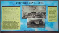
As the frontier moved westward, Fort Ridgely's importance declined. Troops were withdrawn on May 22, 1867, but the buildings and land remained the property of the federal government. Settlers pillaged the fort, carting off stone, wood, and other materials. Squatters turned the commissary into a barn, and even the massive stone barracks—more than 200 feet long and two stories high—was torn down. Ignoring the army's threats to remove them, the illegal homesteaders eventually petitioned the federal government for ownership of the lands they occupied. Legal title was granted in 1874.
The Minnesota Historical Society began archaeological excavations at Fort Ridgely in 1936. Eight building sites were uncovered, and visitors can now see the exposed stone foundations. Site excavations also revealed a long history of Indian occupation prior to the fort's construction. After the excavations were completed, the commissary was rebuilt and used as a museum and assembly hall.
Pillaging the Remains
On one day, no fewer than 100 teams were seen hauling away materials. According to The History of Renville County,
The settlers were all busily engaged picking out the particular material they desired, when word came that a government officer was approaching. One old settler says he never saw anyone move as quickly as did the men there in unloading their wagons and disappearing on the horizon.
Fort Ridgely
Details
| HM Number | HM1DW4 |
|---|---|
| Series | This marker is part of the Minnesota Historical Society series, and the Minnesota: Fort Ridgely Interpretive Series series. |
| Tags | |
| Historical Period | 19th Century |
| Historical Place | Park, Monument, Military Installation, Fort, Battlefield |
| Marker Type | Other |
| Marker Class | Neither |
| Marker Style | Free Standing |
| Placed By | The Minnesota Historical Society |
| Marker Condition | No reports yet |
| Date Added | Monday, September 8th, 2014 at 8:59pm PDT -07:00 |
Pictures
Photo Credits: [1] MARTHA DECKER [2] MARTHA DECKER
Locationbig map
| UTM (WGS84 Datum) | 15T E 361990 N 4923696 |
|---|---|
| Decimal Degrees | 44.45340000, -94.73463333 |
| Degrees and Decimal Minutes | N 44° 27.204', W 94° 44.078' |
| Degrees, Minutes and Seconds | 44° 27' 12.2400" N, 94° 44' 4.6800" W |
| Driving Directions | Google Maps |
| Area Code(s) | 507 |
| Can be seen from road? | Yes |
| Is marker in the median? | No |
| Which side of the road? | Marker is on the right when traveling West |
| Closest Postal Address | At or near 250-294 Co Hwy 30, Fairfax MN 55332, US |
| Alternative Maps | Google Maps, MapQuest, Bing Maps, Yahoo Maps, MSR Maps, OpenCycleMap, MyTopo Maps, OpenStreetMap |
Is this marker missing? Are the coordinates wrong? Do you have additional information that you would like to share with us? If so, check in.
Nearby Markersshow on map
Show me all markers in: Fairfax, MN | Nicollet County | 55332 | Minnesota | United States of America
Maintenance Issues
- This marker could use another picture or two.


Comments 0 comments