Inscription
Cherokee Heritage Trails
You are standing on land that has been part of a town for about three thousand years. This mound was the spiritual, political, and physical center of the Cherokee town of Nikwasi. A council house or town house on top of the mound held the sacred fire, and everyone gathered there to hear news, make decisions, dance, and participate in ceremonies. Surrounding the mound were about one hundred houses, a field for playing stickball, and a dance ground, as well as hundreds of acres of crops, orchards, and gardens.The Cherokee dominated the southern Appalachians for thousands of years. When Alexander Cuming visited Nikwasi in 1730, the Cherokees had men and women leaders in autonomous towns that functioned democratically. Cuming called a council here that was attended by more than two thousand representatives from Cherokee towns. Cuming chose an Emperor, and took a Cherokee delegation to London. In 1761 the British, former allies of the Cherokee, destroyed Nikwasi. After the Cherokees rebuilt, the Americans destroyed it in 1776. The Cherokees rebuilt again and lived here until this area was taken by the Treaty of 1819.
A Cherokee legend tells that spirit warriors came out of the mound to help defend the Cherokee against an attack when the Cherokee men were away hunting. The legend goes on to say that the spirit warriors also saved the town of Franklin from destruction during the Civil War.
The Nikwasi mound is one of the largest surviving mounds in the original Cherokee territory of 140,000 square miles. In 1946, the schoolchildren of Macon County saved their pennies and bought the mound through the Macon County Historical Society to save it from development. It is now owned by the Town of Franklin.
Details
| HM Number | HM1FGF |
|---|---|
| Tags | |
| Year Placed | 2008 |
| Placed By | Cherokee Heritage Trails |
| Marker Condition | No reports yet |
| Date Added | Sunday, September 14th, 2014 at 3:56pm PDT -07:00 |
Pictures
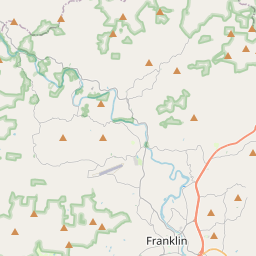
Locationbig map


| UTM (WGS84 Datum) | 17S E 283895 N 3896120 |
|---|---|
| Decimal Degrees | 35.18483333, -83.37335000 |
| Degrees and Decimal Minutes | N 35° 11.09', W 83° 22.401' |
| Degrees, Minutes and Seconds | 35° 11' 5.4" N, 83° 22' 24.06" W |
| Driving Directions | Google Maps |
| Area Code(s) | 828 |
| Which side of the road? | Marker is on the right when traveling West |
| Closest Postal Address | At or near 520-524 E Main St, Franklin NC 28734, US |
| Alternative Maps | Google Maps, MapQuest, Bing Maps, Yahoo Maps, MSR Maps, OpenCycleMap, MyTopo Maps, OpenStreetMap |
Is this marker missing? Are the coordinates wrong? Do you have additional information that you would like to share with us? If so, check in.
Nearby Markersshow on map
Maintenance Issues
- Is this marker part of a series?
- What historical period does the marker represent?
- What historical place does the marker represent?
- What type of marker is it?
- What class is the marker?
- What style is the marker?
- Does the marker have a number?
- This marker needs at least one picture.
- Can this marker be seen from the road?
- Is the marker in the median?
Comments 0 comments