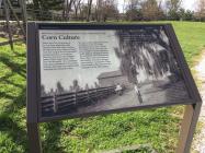
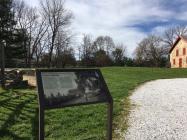
Mule Barn, constructed 1855, Corncrib, ca. 1845, destroyed by fire, 1989
Hampton National Historic Site
There were lots of mouths to feed on a large plantation like Hampton and this made corn an all-important crop. Hard or "dent "corn was used as feed for livestock and ground into cornmeal for slaves as well as for the Ridgelys' pantry. Most importantly, corn was sold for profit. The cornfields here once extended for thousands of acres. The ears were husked and stored in the corncrib to dry.
You can tell how large the corncrib was based on the size of the foundation before you— it held thousands of ears. Once dry, the corn would be shelled and taken to the mill for grinding. Plowing the cornfields was backbreaking labor. Slaves and tenant farmers used mules, housed in the barn seen nearby, to pull plows. These sure-footed workhorses were the "tractors" of the 19th century.
Corn is justly regarded as the national crop of the United States. Its money value is double that of hay, threefold that of wheat, and fourfold that of cotton.Report, Commissioner of Agriculture, Washington, 1862.
(Inscription in the lower right) A view of the corncrib and corn shocks from the Farm Road, ca. 1897. The mule barn and corncrib were located near the cornfields to make planting, harvesting, and processing easier. At harvest time, slaves from nearby plantations came to help husk corn and haul ears to the crib. Husking parties were festive events, with competitions, music, and storytelling.
| HM Number | HM1HNW |
|---|---|
| Tags | |
| Historical Period | 18th Century, 19th Century, 20th Century |
| Historical Place | National Register of Historic Places, Plantation |
| Marker Type | Historic Building |
| Marker Class | Historical Marker |
| Marker Style | Free Standing |
| Placed By | National Park Service-United States Department of the Interior |
| Marker Condition | No reports yet |
| Date Added | Wednesday, November 5th, 2014 at 9:03am PST -08:00 |
| UTM (WGS84 Datum) | 18S E 363375 N 4364654 |
|---|---|
| Decimal Degrees | 39.42060000, -76.58720000 |
| Degrees and Decimal Minutes | N 39° 25.236', W 76° 35.232' |
| Degrees, Minutes and Seconds | 39° 25' 14.1600" N, 76° 35' 13.9200" W |
| Driving Directions | Google Maps |
| Area Code(s) | 410, 443 |
| Can be seen from road? | No |
| Is marker in the median? | No |
| Closest Postal Address | At or near 699 Valley View Rd, Towson MD 21286, US |
| Alternative Maps | Google Maps, MapQuest, Bing Maps, Yahoo Maps, MSR Maps, OpenCycleMap, MyTopo Maps, OpenStreetMap |
Is this marker missing? Are the coordinates wrong? Do you have additional information that you would like to share with us? If so, check in.
- Is this marker part of a series?
- Which side of the road is the marker located?


Comments 0 comments