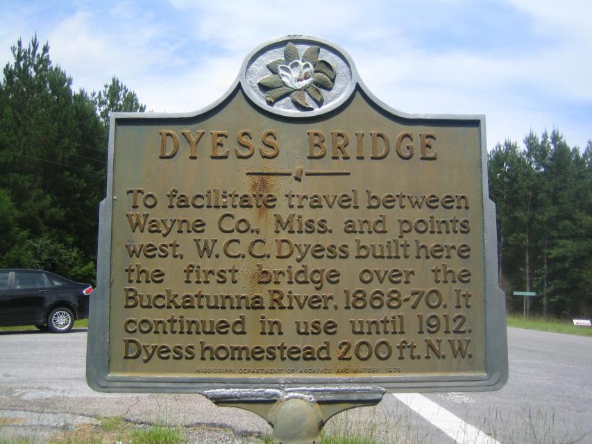
Inscription
To facilitate travel between Wayne Co., Miss. and points west, W.C.C. Dyess built here the first bridge over the Buckatunna River, 1868-70. It continued in use until 1912. Dyess homestead 200 ft. N.W.
Details
| HM Number | HM1IUR |
|---|---|
| Tags | |
| Year Placed | 1979 |
| Placed By | The Mississippi Department of Archives and History |
| Marker Condition | No reports yet |
| Date Added | Sunday, January 18th, 2015 at 1:02pm PST -08:00 |
Pictures
Locationbig map
| UTM (WGS84 Datum) | 16R E 356098 N 3507613 |
|---|---|
| Decimal Degrees | 31.69483333, -88.51840000 |
| Degrees and Decimal Minutes | N 31° 41.69', W 88° 31.104' |
| Degrees, Minutes and Seconds | 31° 41' 41.4" N, 88° 31' 6.24" W |
| Driving Directions | Google Maps |
| Area Code(s) | 601 |
| Which side of the road? | Marker is on the right when traveling West |
| Closest Postal Address | At or near 501-513 Big Rock Rd, Waynesboro MS 39367, US |
| Alternative Maps | Google Maps, MapQuest, Bing Maps, Yahoo Maps, MSR Maps, OpenCycleMap, MyTopo Maps, OpenStreetMap |
Is this marker missing? Are the coordinates wrong? Do you have additional information that you would like to share with us? If so, check in.
Nearby Markersshow on map
Show me all markers in: Waynesboro, MS | Wayne County | 39367 | Mississippi | United States of America
Maintenance Issues
- Is this marker part of a series?
- What historical period does the marker represent?
- What historical place does the marker represent?
- What type of marker is it?
- What class is the marker?
- What style is the marker?
- Does the marker have a number?
- This marker could use another picture or two.
- Can this marker be seen from the road?
- Is the marker in the median?
Comments 0 comments