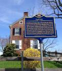
Inscription
James Boulden the Elder and his family moved to Delaware from Maryland in the mid-18th century, amassing wealth and expanding their land ownership in Pencader Hundred as the century progressed. The two-story brick mansion house was built during this time period and is a strong representation of Georgian architecture. A service wing erected between 1800-1820 was added to the main structure and is a rare example of stone construction in this area. Five outbuildings situated on the property include a corncrib/granary, a smoke house, a dairy barn and stable, a milk house, and an open frame shed for cattle. In the 1820s, son James ran a diversified farming operation; growing corn, wheat and hay; raising cattle for beef and dairy; using houses and oxen to work the fields; and producing wool from sheep. During the 19th century the farm increasingly focused on dairying, producing milk and butter for the Mid-Atlantic urban markets. After son James' passing in 1826, the farm was left to his grate-nephew and namesake. Circa 1850, James Boulden III carried out substantial renovations to the mansion house incorporating several "Revival" styles, evident in the ornate woodwork and a reorganization of the interior space. The farm remained in the hands of the Boulden family and their descendants until 1918, when the sale of the property ended their 175-year ownership. The architectural and agricultural importance of Poplar Hall was recognized when the property was named to the National Register of Historic Places on January 26, 1988.
Details
| HM Number | HM1RVE |
|---|---|
| Marker Number | NC-203 |
| Year Placed | 2014 |
| Placed By | Delaware Public Archives |
| Marker Condition |           10 out of 10 (1 reports) |
| Date Added | Monday, April 25th, 2016 at 9:03am PDT -07:00 |
Pictures
Photo Credits: [1] GSHELTON
Locationbig map
| UTM (WGS84 Datum) | 18S E 433462 N 4378758 |
|---|---|
| Decimal Degrees | 39.55593333, -75.77450000 |
| Degrees and Decimal Minutes | N 39° 33.356', W 75° 46.47' |
| Degrees, Minutes and Seconds | 39° 33' 21.36" N, 75° 46' 28.2" W |
| Driving Directions | Google Maps |
| Area Code(s) | 302 |
| Which side of the road? | Marker is on the right when traveling East |
| Closest Postal Address | At or near 3159-3299 Denny Rd, Newark DE 19702, US |
| Alternative Maps | Google Maps, MapQuest, Bing Maps, Yahoo Maps, MSR Maps, OpenCycleMap, MyTopo Maps, OpenStreetMap |
Is this marker missing? Are the coordinates wrong? Do you have additional information that you would like to share with us? If so, check in.
Nearby Markersshow on map
Show me all markers in: Newark, DE | New Castle County | 19702 | Delaware | United States of America
Maintenance Issues
- Is this marker part of a series?
- This markers needs some tags to help categorize the marker
- What historical period does the marker represent?
- What historical place does the marker represent?
- What type of marker is it?
- What class is the marker?
- What style is the marker?
- This marker could use another picture or two.
- Can this marker be seen from the road?
- Is the marker in the median?

Comments 0 comments