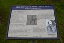
Inscription
A Wild And Desolate Scene
The 1st West Virginia Cavalry arrived and were ordered to charge the Confederate cannon on this side of the bridge. Seeing the West Virginians in their front, Confederate Captain William Tanner ordered the cannon to fire its last two shots before the gun was captured. Immediately thereafter, the West Virginians, supported by portions of Custer's brigade, began storming through the long line of wagons. In some instances they were ordered to shoot the lead horses of the wagon train, putting a halt to their escape, while collecting their bounty and setting fire to many Confederate wagons.As the Union cavalry descended South Mountain, area citizens witnessed a Fourth of July like no other. They saw the fires from the wagons extending from Monterey Pass down South Mountain and continuing into Maryland, when the battle finally ended at Ringgold just after dawn. They were also able to see the fires extending from Leitersburg to Ringgold, as the 1st Vermont Cavalry cut its own path of destruction through the wagons that were the head of the column, moving toward Williamsport, Maryland.
Pictures
Photo Credits: [1] DOUGLAS MOWEN
Locationbig map
| UTM (WGS84 Datum) | 18S E 287532 N 4401657 |
|---|---|
| Decimal Degrees | 39.73835000, -77.47950000 |
| Degrees and Decimal Minutes | N 39° 44.301', W 77° 28.770' |
| Degrees, Minutes and Seconds | 39° 44' 18.06" N, 77° 28' 46.2" W |
| Driving Directions | Google Maps |
| Area Code(s) | 717 |
| Can be seen from road? | Yes |
| Is marker in the median? | No |
| Which side of the road? | Marker is on the right when traveling East |
| Closest Postal Address | At or near 14218-14286 Charmian Rd, Waynesboro PA 17268, US |
| Alternative Maps | Google Maps, MapQuest, Bing Maps, Yahoo Maps, MSR Maps, OpenCycleMap, MyTopo Maps, OpenStreetMap |
Is this marker missing? Are the coordinates wrong? Do you have additional information that you would like to share with us? If so, check in.
Nearby Markersshow on map
Show me all markers in: Waynesboro, PA | Franklin County | 17268 | Pennsylvania | United States of America
The Battle of Monterey Pass
The Battle of Monterey Pass
Battle of Monterey Pass (Reinforcements)
Brown's Spring
The Battle of Monterey Pass
Corporal Joseph Brubaker, Jr.
Battle of Monterey Pass/Michigan Cavalry Brigade
The Retreat From Gettysburg
Battle of Monterey Pass (Wolverines)
10,000 Soldiers Fight at Monterey Pass
Maintenance Issues
- Who or what organization placed the marker?
- This marker could use another picture or two.

Comments 0 comments