Inscription
Lest We Forget
This tablet presented February 9, 1979, to the Veterans Memorial Park, in loving memory of the many veterans, nurses, and aids of the San Fernando Valley Veterans Hospital, whose lives were lost during the earthquake of February 9, 1971.Details
| HM Number | HM25PC |
|---|---|
| Additional Information | The Sylmar Earthquake occurred at 6:00 am on February 9, 1971. It registered 6.6 on the Richter scale. 64 people were killed, including 44 at this hospital, which is now a memorial park. The nearby Olive View Hospital was damaged, resulting in three deaths. 80,000 people were evacuated (including me, -CB) when the Van Norman Dam nearly collapsed. The earthquake released methane gas underground into a tunnel construction site in Sylmar, and on June 24 an explosion killed 17 workers. The 1994 Northridge Earthquake had a similar magnitude, duration, time of day, time of year, damage, number of fatalities, and area affected, as the 1971 earthquake. And geologists believe the 1971 earthquake caused the 1994 earthquake. |
| Series | This marker is part of the Daughters of the American Revolution series |
| Tags | |
| Historical Period | 20th Century |
| Historical Place | Park, Other, Medical Facility |
| Marker Type | Memorial |
| Marker Class | Historical Marker |
| Marker Style | Mounted |
| Year Placed | 1979 |
| Placed By | Daughters of the American Revolution |
| Marker Condition |  9 out of 10 (1 reports) |
| Date Added | Tuesday, February 27th, 2018 at 7:02pm PST -08:00 |
Pictures

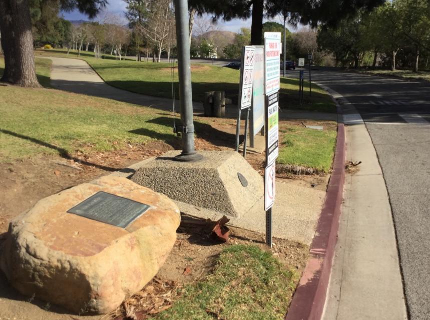

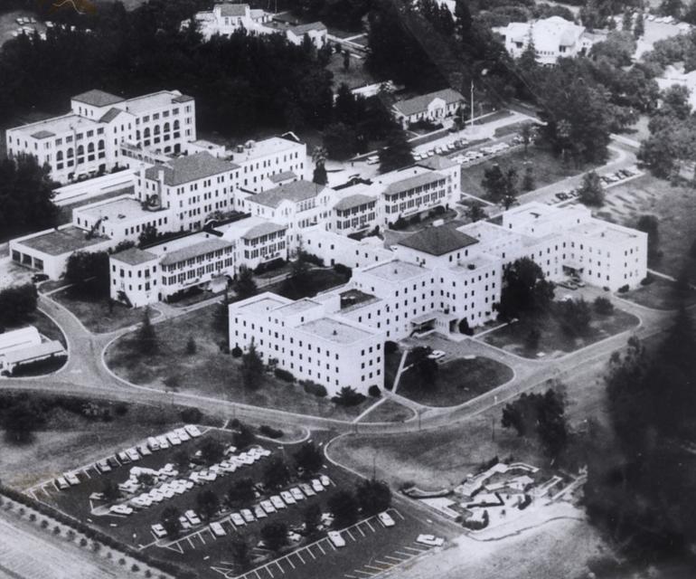
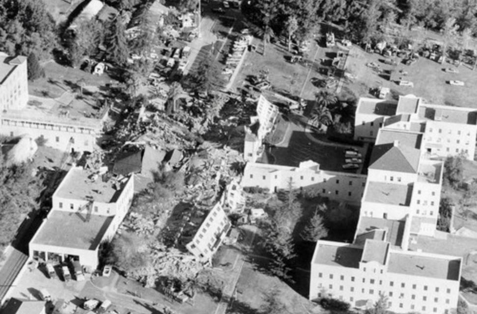


Photo Credits: [1] CRAIG BAKER [2] CB [3] CB [7] CB
Locationbig map
| Directions Information | At the end of Sayre Street, by the flagpole at the entrance to Veterans Memorial Park. |
|---|---|
| UTM (WGS84 Datum) | 11S E 369642 N 3799117 |
| Decimal Degrees | 34.32515000, -118.41696667 |
| Degrees and Decimal Minutes | N 34° 19.509', W 118° 25.018' |
| Degrees, Minutes and Seconds | 34° 19' 30.5400" N, 118° 25' 1.0800" W |
| Driving Directions | Google Maps |
| Can be seen from road? | Yes |
| Is marker in the median? | No |
| Which side of the road? | Marker is on the right when traveling West |
| Closest Postal Address | At or near 13001 Sayre St, Los Angeles CA , US |
| Alternative Maps | Google Maps, MapQuest, Bing Maps, Yahoo Maps, MSR Maps, OpenCycleMap, MyTopo Maps, OpenStreetMap |
Is this marker missing? Are the coordinates wrong? Do you have additional information that you would like to share with us? If so, check in.
Nearby Markersshow on map
Show me all markers in: Los Angeles, CA | Los Angeles County | California | United States of America
Maintenance Issues
- Area Code
Comments 0 comments