Inscription
City of Alexandria Est. 1749
—Potomac Yard —
The Potomac Yard site has historically been an intersection for transportation because of its location between Washington D.C. and Alexandria and the availability of open, level land near the river. Even before Potomac Yard was built, the property hosted a canal, turnpike, and two railroad lines, all of which were intended to draw precious freight and trade income into Alexandria from competitors Washington D.C. and Baltimore, Maryland.The 1878 map of Alexandria region above illustrates the numerous forms of transportation that criss-crossed the future Potomac Yard site. When this map was made, the canal had been abandoned for more than 10 years, but the canal channel remained intact.
Turnpikes and Roads
By the late 18th and 19th centuries, physical barriers to Alexandria's trade with western territories—such as the Blue Ridge Mountains and falls of the Potomac River—were addressed by the construction of roads. One of the most important roads was the Washington and Alexandria Turnpike. Begun in 1808, the turnpike connected Alexandria with Washington, D.C. and help draw both trade goods and new residents to the Alexandria area. The turnpike would eventually become part of Route 1 in 1926; one of the first interstate highway systems in the United States.
Railroads For Passengers
and Freight
Two railroads marked the beginning of train travel in and near Alexandria and foreshadowed the construction of Potomac Yard: the Alexandria, Loudoun, and Hampshire Railroad (AL&H) beginning in 1853 and the Alexandria and Washington Railroad (A&W) beginning in 1854. The AL&H transported passengers from a station at nearby St. Asaph Washington, D.C.
Canals, Locks, and Aqueducts
The Alexandria Canal was constructed between 1831 and 1843 to supplement shipment of freight via roads. Boats on the Alexandria Canal carried primarily coal and agricultural products such as corn, flour, wheat, and whiskey. When a vital aqueduct bridge over the Potomac was drained during the Civil War (1861-1864), the canal fell into disrepair and was never again fully utilized. The officially abandoned in 1886, after more than 40 years of use, because of high maintenance costs and reduced demand due to an increase in railroad traffic.
The Aqueduct Bridge over the Potomac River, shown at left, is similar to the aqueduct that allowed canal boats to float over Four Mile Run toward Alexandria.
Details
| HM Number | HM26GW |
|---|---|
| Tags | |
| Placed By | City of Alexandria |
| Marker Condition | No reports yet |
| Date Added | Sunday, April 1st, 2018 at 7:01am PDT -07:00 |
Pictures
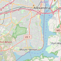
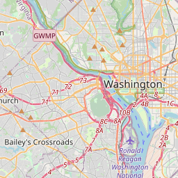
Locationbig map

| UTM (WGS84 Datum) | 18S E 322191 N 4299103 |
|---|---|
| Decimal Degrees | 38.82278333, -77.04821667 |
| Degrees and Decimal Minutes | N 38° 49.367', W 77° 2.893' |
| Degrees, Minutes and Seconds | 38° 49' 22.02" N, 77° 2' 53.58" W |
| Driving Directions | Google Maps |
| Area Code(s) | 202, 703, 571 |
| Which side of the road? | Marker is on the right when traveling North |
| Closest Postal Address | At or near Potomac Yard Trail, Alexandria VA 22314, US |
| Alternative Maps | Google Maps, MapQuest, Bing Maps, Yahoo Maps, MSR Maps, OpenCycleMap, MyTopo Maps, OpenStreetMap |
Is this marker missing? Are the coordinates wrong? Do you have additional information that you would like to share with us? If so, check in.
Nearby Markersshow on map
Maintenance Issues
- Is this marker part of a series?
- What historical period does the marker represent?
- What historical place does the marker represent?
- What type of marker is it?
- What class is the marker?
- What style is the marker?
- Does the marker have a number?
- What year was the marker erected?
- This marker needs at least one picture.
- Can this marker be seen from the road?
- Is the marker in the median?
Comments 0 comments