Inscription
The Halloran Block was designed by City of Lead Architect J. A. Archibald and was completed for James Halloran in December, 1897. Mr. Halloran originally came to the Black Hills with the Custer Expedition of 1874. James Halloran was a prime mover in the consummation of the Hidden Fortune Mine, northwest of Lead. He also was part owner of the Dolphin and Comstock operations, located on Yellow Creek, south of town. The Dolphin and Comstock Group was part of the great Homestake ore trend.
The Halloran Building has been home to a variety of businesses, including restaurants, saloons, a hotel, a boarding house and a hardware store. The building survived the fire of 1904 that destroyed a quarter of the City of Lead.
During the 1920's and 1930's underground rock pillars in the Homestake Mine began to collapse resulting in surface subsidence in the center of the town of Lead. Several buildings were severely damaged and the threat of continued subsidence required that the center of the town of Lead be moved. The town was moved to the west to its present location. The subsidence area is now part of the Open Cut.
The Halloran Block survived the subsidence and now stands as one of the oldest buildings in the City of Lead. Minimal exterior work has allowed the Halloran Block to retain its character and stature as a landmark
location within the community.
Details
| HM Number | HM2ACG |
|---|---|
| Tags | |
| Marker Condition | No reports yet |
| Date Added | Tuesday, August 14th, 2018 at 10:03am PDT -07:00 |
Pictures
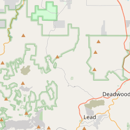
Locationbig map


| UTM (WGS84 Datum) | 13T E 598325 N 4911700 |
|---|---|
| Decimal Degrees | 44.35191667, -103.76628333 |
| Degrees and Decimal Minutes | N 44° 21.115', W 103° 45.977' |
| Degrees, Minutes and Seconds | 44° 21' 6.8999999999999" N, 103° 45' 58.62" W |
| Driving Directions | Google Maps |
| Area Code(s) | 605 |
| Which side of the road? | Marker is on the right when traveling East |
| Closest Postal Address | At or near 303 W Main St, Lead SD 57754, US |
| Alternative Maps | Google Maps, MapQuest, Bing Maps, Yahoo Maps, MSR Maps, OpenCycleMap, MyTopo Maps, OpenStreetMap |
Is this marker missing? Are the coordinates wrong? Do you have additional information that you would like to share with us? If so, check in.
Nearby Markersshow on map
Show me all markers in: Lead, SD | Lawrence County | 57754 | South Dakota | United States of America
Maintenance Issues
- Is this marker part of a series?
- What historical period does the marker represent?
- What historical place does the marker represent?
- What type of marker is it?
- What class is the marker?
- What style is the marker?
- Does the marker have a number?
- What year was the marker erected?
- Who or what organization placed the marker?
- This marker needs at least one picture.
- Can this marker be seen from the road?
- Is the marker in the median?

Comments 0 comments