Inscription
Heights & Sights to the North & East
The commanding view from Fleetwood Hill rendered this "Famous Plateau" an ideal observation post during the war. Today the view looks much as it did in the 1860s.1.STONY MOUNTAIN
The headwaters of the Rapidan River flow from the base of the Blue Ridge mountain.
2.OLD RAG
A prominent summit in the Blue Ridge.
3.HAZEL MOUNTAIN
The Hazel River flows from this Blue Ridge Mountain and enters the Rappahannock River just above Beverly Ford.
4.BEAUREGARD (Barbour House)
Gen. Robert E. Lee watched the closing phases of the Battle of Brandy Station from the cupola atop the house, which was named in honor of Confederate Gen. P.G.T. Beauregard.
5.NORTH FLEETWOOD HILL
Union Gen. John Buford's final attacks at Brandy Station gained the northern crest of the hill.
6.MEADE'S HEADQUARTERS
Union Gen. George G. Meade, commander of the Army of the Potomac, made his winter headquarters here in 1863-1864.
7.ST. JAMES CHURCH
The church sat on the plateau where the Confederates anchored their defense against Union Gen. John Buford's first attack toward Brandy Station. The Federals demolished it for hut-building materials in December 1863.
8.BEVERLY FORD
In the opening phase of the Battle of Brandy Station, Union Gen.
John Buford's "right wing" crossed the Rappahannock River here early in the morning of June 9, 1863.
Details
| HM Number | HM2F9Y |
|---|---|
| Tags | |
| Placed By | Civil War Trails and Civil War Trust |
| Marker Condition | No reports yet |
| Date Added | Sunday, March 31st, 2019 at 11:01am PDT -07:00 |
Pictures
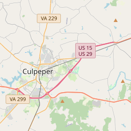
Locationbig map


| UTM (WGS84 Datum) | 18S E 248942 N 4266214 |
|---|---|
| Decimal Degrees | 38.50893333, -77.87925000 |
| Degrees and Decimal Minutes | N 38° 30.536', W 77° 52.755' |
| Degrees, Minutes and Seconds | 38° 30' 32.16" N, 77° 52' 45.3" W |
| Driving Directions | Google Maps |
| Which side of the road? | Marker is on the right when traveling East |
| Closest Postal Address | At or near , , |
| Alternative Maps | Google Maps, MapQuest, Bing Maps, Yahoo Maps, MSR Maps, OpenCycleMap, MyTopo Maps, OpenStreetMap |
Is this marker missing? Are the coordinates wrong? Do you have additional information that you would like to share with us? If so, check in.
Nearby Markersshow on map
Show me all markers in:
Battle of Brandy Station
Battle of Brandy Station Historical
Battle of Brandy Station Historical
Battle of Brandy Station Historical
Battle of Brandy Station Historical
Battle of Brandy Station Historical
Battle of Brandy Station Historical
Battle of Brandy Station Historical
George C. Hupp, a War Memorial
Battle of Brandy Station
Maintenance Issues
- What country is the marker located in?
- Is this marker part of a series?
- What historical period does the marker represent?
- What historical place does the marker represent?
- What type of marker is it?
- What class is the marker?
- What style is the marker?
- Does the marker have a number?
- What year was the marker erected?
- This marker needs at least one picture.
- Can this marker be seen from the road?
- Is the marker in the median?

Comments 0 comments