Inscription
Furman University, whose campus was once located nearby, donated the original six areas, followed by other land grants from adjoining property owners. Over the next two decades the Garden Club, in partnership with the city, continued to protect, expand and develop the area.
In 1975, a small house, known today as Falls Cottage, was acquired and restored. A master development and beautification project was begun in 1990 with city and garden club funds augmented with generous support from foundations, corporations, and individuals. Falls Park, listed on the National Register of Historic Places, encompasses 26 acres with nature trails, landscaped gardens, a pond, expansion bridge, scenic overlooks, textile mill ruins, and historic informational plaques.
Love of history, appreciation for nature's beauties and a desire to preserve it for all public enjoyment have motivated the work done here...a place restored to life.
Details
| HM Number | HMILH |
|---|---|
| Tags | |
| Marker Condition | No reports yet |
| Date Added | Saturday, October 11th, 2014 at 5:08pm PDT -07:00 |
Pictures
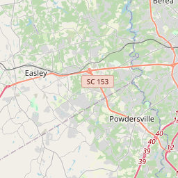
Locationbig map


| UTM (WGS84 Datum) | 17S E 371849 N 3856718 |
|---|---|
| Decimal Degrees | 34.84471667, -82.40166667 |
| Degrees and Decimal Minutes | N 34° 50.683', W 82° 24.1' |
| Degrees, Minutes and Seconds | 34° 50' 40.98" N, 82° 24' 6.00" W |
| Driving Directions | Google Maps |
| Area Code(s) | 803, 864 |
| Closest Postal Address | At or near 929 Liberty Bridge, Greenville SC 29601, US |
| Alternative Maps | Google Maps, MapQuest, Bing Maps, Yahoo Maps, MSR Maps, OpenCycleMap, MyTopo Maps, OpenStreetMap |
Is this marker missing? Are the coordinates wrong? Do you have additional information that you would like to share with us? If so, check in.
Nearby Markersshow on map
Maintenance Issues
- Is this marker part of a series?
- What historical period does the marker represent?
- What historical place does the marker represent?
- What type of marker is it?
- What class is the marker?
- What style is the marker?
- Does the marker have a number?
- What year was the marker erected?
- Who or what organization placed the marker?
- This marker needs at least one picture.
- Can this marker be seen from the road?
- Is the marker in the median?

Comments 0 comments