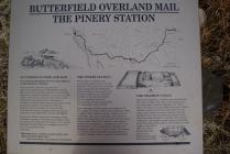
"The Pinery" or
"Pine Spring" stage stand
Built in 1858 as a station on the Butterfield overland mail route St. Louis to San Francisco · Abandoned in 1859, when the line was shifted to the Davis Mountain route.
| HM Number | HMK9Q |
|---|---|
| Tags | |
| Year Placed | 1936 |
| Placed By | State of Texas |
| Marker Condition |           9 out of 10 (1 reports) |
| Date Added | Monday, September 22nd, 2014 at 2:52am PDT -07:00 |
| UTM (WGS84 Datum) | 13R E 517281 N 3528625 |
|---|---|
| Decimal Degrees | 31.89331667, -104.81725000 |
| Degrees and Decimal Minutes | N 31° 53.599', W 104° 49.035' |
| Degrees, Minutes and Seconds | 31° 53' 35.94" N, 104° 49' 2.10" W |
| Driving Directions | Google Maps |
| Area Code(s) | 915 |
| Closest Postal Address | At or near 210-298 The Pinery Trail, Monterey TX 79847, US |
| Alternative Maps | Google Maps, MapQuest, Bing Maps, Yahoo Maps, MSR Maps, OpenCycleMap, MyTopo Maps, OpenStreetMap |
Is this marker missing? Are the coordinates wrong? Do you have additional information that you would like to share with us? If so, check in.
I Saw The Marker
This is a beautiful, rough, rugged site. It is dominated by arid land and the heights of mountains overlooking it.
Aug 13, 2015 at 9:01am PDT by profsporrster
- Is this marker part of a series?
- What historical period does the marker represent?
- What historical place does the marker represent?
- What type of marker is it?
- What class is the marker?
- What style is the marker?
- Does the marker have a number?
- Can this marker be seen from the road?
- Is the marker in the median?


Comments 0 comments