George Landcraft - Designer
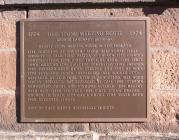
Oldest Stone Meeting House in New England
Gift of East Haven Historical Society
| HM Number | HMNSI |
|---|---|
| Tags | |
| Year Placed | 1974 |
| Placed By | East Haven Historical Society |
| Marker Condition |           6 out of 10 (2 reports) |
| Date Added | Tuesday, October 7th, 2014 at 8:10pm PDT -07:00 |
| UTM (WGS84 Datum) | 18T E 678242 N 4571838 |
|---|---|
| Decimal Degrees | 41.27831667, -72.87171667 |
| Degrees and Decimal Minutes | N 41° 16.699', W 72° 52.303' |
| Degrees, Minutes and Seconds | 41° 16' 41.94" N, 72° 52' 18.18" W |
| Driving Directions | Google Maps |
| Area Code(s) | 203 |
| Closest Postal Address | At or near 1-9 High St, East Haven CT 06512, US |
| Alternative Maps | Google Maps, MapQuest, Bing Maps, Yahoo Maps, MSR Maps, OpenCycleMap, MyTopo Maps, OpenStreetMap |
Is this marker missing? Are the coordinates wrong? Do you have additional information that you would like to share with us? If so, check in.
I Saw The Marker
The marker could use a cleaning, otherwise it is in good condition and readable. There's a typo in the marker write up--the tornado blew down steeple in 1797 not 1979.
Apr 25, 2016 at 11:48am PDT by wolak
I Saw The Marker
Some Idiot scratched an incoherent message between edge and start of listing.
Oct 13, 2015 at 10:11am PDT by tvcat
- Is this marker part of a series?
- What historical period does the marker represent?
- What historical place does the marker represent?
- What type of marker is it?
- What class is the marker?
- What style is the marker?
- Does the marker have a number?
- This marker could use another picture or two.
- Can this marker be seen from the road?
- Is the marker in the median?

Comments 0 comments