Inscription
I have ordered Generals Sigel and Davis to move with their divisions during the night and form on the left of Carr's division ... and be ready to renew the battle at daylight. The enemy will concentrate his whole force at Elk Horn; we will fight him there tomorrow...[I am] certain of success on the coming day.
Samuel Curtis, major general commanding, United States Army of the Southwest
From this overlook you can see the great challenge facing General Samuel Curtis as two armies grappled on Pea Ridge - how to turn the 10,500 men in the Union army from facing south to facing north, while keeping his supply wagons from being captured.
After night fell, Federal divisions that had fought at Leetown had to be brought together with the battered defenders astride the Telegraph Road you see below. Cold and hungry Union men who had marched most of the night had to be fed and issued fresh ammunition.
Thousands of men and horses, hundreds of wagons, and dozens of cannons jostled along narrow country roads in the dark. Union officers took little comfort in knowing that the Confederates faced the same demanding task that winter night. Both armies had to reorganize and resupply to be able to fight again.
Details
| HM Number | HMNT7 |
|---|---|
| Tags | |
| Placed By | Pea Ridge National Military Park - National Park Service - U.S. Department of the Interior |
| Marker Condition | No reports yet |
| Date Added | Saturday, September 6th, 2014 at 7:18am PDT -07:00 |
Pictures
Locationbig map
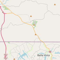

| UTM (WGS84 Datum) | 15S E 408338 N 4034810 |
|---|---|
| Decimal Degrees | 36.45416667, -94.02290000 |
| Degrees and Decimal Minutes | N 36° 27.25', W 94° 1.374' |
| Degrees, Minutes and Seconds | 36° 27' 15.00" N, 94° 1' 22.44" W |
| Driving Directions | Google Maps |
| Area Code(s) | 479 |
| Closest Postal Address | At or near 39 County Rd 65, Garfield AR 72732, US |
| Alternative Maps | Google Maps, MapQuest, Bing Maps, Yahoo Maps, MSR Maps, OpenCycleMap, MyTopo Maps, OpenStreetMap |
Is this marker missing? Are the coordinates wrong? Do you have additional information that you would like to share with us? If so, check in.
Nearby Markersshow on map
Maintenance Issues
- Is this marker part of a series?
- What historical period does the marker represent?
- What historical place does the marker represent?
- What type of marker is it?
- What class is the marker?
- What style is the marker?
- Does the marker have a number?
- What year was the marker erected?
- This marker needs at least one picture.
- Can this marker be seen from the road?
- Is the marker in the median?
Comments 0 comments