Inscription
September 19, 1861
— Second Kiosk —
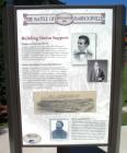
(First Panel):Building Union Support
Tennessee Unionists Revolt
Tennessee seceded from the Union in June 1861. Most people in Middle and West Tennessee supported that action but a large number of East Tennesseans did no. East Tennesseans were soon in open revolt against the Confederacy. Unionists burned bridges and harassed Confederate sympathizers. In June 1861, Confederate General Felix K. Zollicoffer arrived in Knoxville with 4,000 soldiers to "preserve peace, protect the railroads and repel invasion."
Nelson Establishes Camp Robinson
Kentucky declared itself neutral shortly after the beginning of the Civil War. Over the summer of 1861 that neutrality took a beating but it held. During that long, hot summer Lieut. (later General) William "Bull" Nelson established Camp Dick Robinson, a Union recruiting camp, in Garrard County. Nelson secured 5,000 "Lincoln guns" that he delivered to Union army recruits. This flagrant disregard for the state's neutrality outraged Kentucky Governor Beriah Magoffin. He demanded that the recruiting camp be removed from Kentucky soil. Abraham Lincoln quickly replied: "I do not believe it is the popular wish of Kentucky that this force shall be removed beyond her limits; and, with this impression, I must respectfully decline to move it."
Camp Andy Johnson
the establishment of Camp Dick Robinson was part of a plan to free the Unionists of East Tennessee. Nelson and Samuel P. Carter, agents of the Federal government, were sent south to organize armies from the loyal men of Kentucky and East Tennessee. Samuel Carter hoped to establish a similar camp in Tennessee. His hopes were dashed when he received word from his brother, James, that the Confederate government in East Tennessee was arresting anyone found in a Union uniform. Faced with hostility in Tennessee, the Carter brothers located their recruiting camp, Camp Andy Johnson, in Barbourville.
(Second Panel):
The Home Guard
Knox County's Loyal Militia
In 1860, Simon B. Buckner revitalized the old state militia in Kentucky. The law required all white males between the ages of 18 and 45 to enlist in the Enrolled Militia. Buckner helped organize and trade over 60 active militia companies, known as the State Guard. Buckner's State Guard was pro-Southern. To counter Buckner, Unionists began organizing their own militia companies, known as the Home Guard.
The rolls of the Enrolled Militia in Knox County contained the names of some 1,100 men. Three hundred of these men joined the Home Guard. The militia company captains were John G. Eve, A.D. Catron and Isaac J. Black. Captain John G. Eve was given the rank of colonel and placed in command of the Home Guard in Knox County. In June 1861, the Knox County Home Guard requested 300 weapons from the Adjutant General in Frankfort for distribution to the militia.
Barbourville Honors the Home Guard
As part of a July 4 celebration in Barbourville the Home Guard participated in a stirring martial ceremony. They marched from the court square to a site near what is today Knox Central Middle School. There, with their new rifles polished, the Home Guard stood at attention as one thousand loyal citizens of Knox County looked on. Speeches were made befitting the day. After a speech by Kate Adams, a flag made by the ladies of Barbourville was presented to the Home Guard.
The Home Guard Defends Barbourville
On September 19, 1861, a handful of Home Guard defended Barbourville. They faced an well-armed detachment of Confederate infantry determined to invade the city.
(Third Panel):
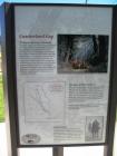
Cumberland Gap
18th Century Gateway to Kentucky
In the 18th century, most of those entering Kentucky from Virginia, North Carolina and East Tennessee passed through Cumberland Gap. Most trails through the Gap, including Skagg's Trace, Boone's Trace and the Wilderness Road, followed part of the Warrior's Path, a very old Native American trail, as far as Flat Lick. In 1750, Dr. Thomas Walker of Virginia came through the Gap into Kentucky. He built the first log house in Kentucky just a few miles southeast of Barbourville. Others soon followed Walker, including Henry Skaggs, Richard Skaggs and Daniel Boone. After the American Revolution the Wilderness Road became the southern gateway to Kentucky and the west.
Strategic Civil War Location
When the Civil War began, Lincoln sent Samuel P. Carter and William "Bull" Nelson, two stanch Unionists, to Kentucky. The Gap, they determined, was the shortest route for a strike into the midriff of the Confederacy. However in late summer 1861 General Felix Zollicoffer marched his army from Knoxville, securing the Gap for the Confederates and thwarting Carter's plans for an invasion of East Tennessee.
Cumberland Gap changed hands several times during the war before Union forces conclusively secured it in September 1863.
Grant's Verdict
In the winter of 1864 Gen. Ulysses S. Grant examined the State Road for use as an invasion and supply route into Tennessee. Grant spent the night at Barbourville before rejecting the old road, which was in very poor condition. Grant later wrote that the road was full of "holes and knobs" and that his ride was "a rather cheerless one, and very disagreeable.
Details
| HM Number | HMNXU |
|---|---|
| Tags | |
| Marker Condition | No reports yet |
| Date Added | Friday, October 3rd, 2014 at 9:36pm PDT -07:00 |
Pictures
Photo Credits: [1] DARYL SKAGGS [2] DARYL SKAGGS [3] DARYL SKAGGS [4] DARYL SKAGGS [5] DARYL SKAGGS
Locationbig map
| UTM (WGS84 Datum) | 17S E 242770 N 4083962 |
|---|---|
| Decimal Degrees | 36.86660000, -83.88561667 |
| Degrees and Decimal Minutes | N 36° 51.996', W 83° 53.137' |
| Degrees, Minutes and Seconds | 36° 51' 59.76" N, 83° 53' 8.22" W |
| Driving Directions | Google Maps |
| Area Code(s) | 606 |
| Closest Postal Address | At or near 231-241 Daniel Boone Dr, Barbourville KY 40906, US |
| Alternative Maps | Google Maps, MapQuest, Bing Maps, Yahoo Maps, MSR Maps, OpenCycleMap, MyTopo Maps, OpenStreetMap |
Is this marker missing? Are the coordinates wrong? Do you have additional information that you would like to share with us? If so, check in.
Nearby Markersshow on map
Maintenance Issues
- Is this marker part of a series?
- What historical period does the marker represent?
- What historical place does the marker represent?
- What type of marker is it?
- What class is the marker?
- What style is the marker?
- Does the marker have a number?
- What year was the marker erected?
- Who or what organization placed the marker?
- Can this marker be seen from the road?
- Is the marker in the median?


Comments 0 comments