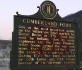
Inscription
One of the most important points on the Wilderness Road marked by Daniel Boone in 1775. Ford first used by Indians, then by early explorers and the Long Hunters. After Boone opened the way west, more than 100,000 settlers used the crossing as a gateway to Ky. During the Civil War ford occupied by both Union and CSA troops because of its strategic location.
Details
| HM Number | HMNXV |
|---|---|
| Series | This marker is part of the Kentucky: Kentucky Historical Society series |
| Tags | |
| Historical Period | 18th Century |
| Historical Place | River |
| Marker Type | Historic Structure |
| Marker Class | Historical Marker |
| Marker Style | Mounted |
| Marker Number | 1426 |
| Year Placed | 1971 |
| Placed By | Kentucky Historical Society - Kentucky Department of Highways |
| Marker Condition |           7 out of 10 (1 reports) |
| Date Added | Friday, October 3rd, 2014 at 5:46pm PDT -07:00 |
Pictures
Photo Credits: [1] DARYL SKAGGS
Locationbig map
| UTM (WGS84 Datum) | 17S E 259558 N 4072038 |
|---|---|
| Decimal Degrees | 36.76365000, -83.69371667 |
| Degrees and Decimal Minutes | N 36° 45.819', W 83° 41.623' |
| Degrees, Minutes and Seconds | 36° 45' 49.1400" N, 83° 41' 37.3800" W |
| Driving Directions | Google Maps |
| Area Code(s) | 606 |
| Can be seen from road? | Yes |
| Is marker in the median? | Yes |
| Closest Postal Address | At or near US-25E, Pineville KY 40977, US |
| Alternative Maps | Google Maps, MapQuest, Bing Maps, Yahoo Maps, MSR Maps, OpenCycleMap, MyTopo Maps, OpenStreetMap |
Is this marker missing? Are the coordinates wrong? Do you have additional information that you would like to share with us? If so, check in.
Nearby Markersshow on map
Maintenance Issues
- This marker could use another picture or two.

Comments 0 comments