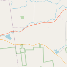
In 1666, French captain Pierre de Saint Paul, Sieur de la Motte, was detailed with 300 men to construct a fort on this site, for defense against the English and Iroquois. Upon completion, the fort was blessed and dedicated to Saint Anne. In their wake, the soil here has been trod by many a landing party, but few have stayed very long. Generations of pilgrims have left only a handful of relics in the earth, but they have filled the air with prayer and memories.
"I remember." "Je me souviens." "Nemikwaldamnana." The landing is a shrine to memory, whose "remains" live deep within each of us. Landings are always a meeting ground of the known and the unknown. Standing here at this landing, poised for the 400th anniversary of Champlain's pilgrimage, what new acts of remembering will we perform.
| HM Number | HMXBE |
|---|---|
| Tags | |
| Placed By | Lake Champlain Historic Landings Heritage Trail |
| Marker Condition | No reports yet |
| Date Added | Thursday, October 16th, 2014 at 4:10am PDT -07:00 |


| UTM (WGS84 Datum) | 18T E 630414 N 4973198 |
|---|---|
| Decimal Degrees | 44.90026667, -73.34818333 |
| Degrees and Decimal Minutes | N 44° 54.016', W 73° 20.891' |
| Degrees, Minutes and Seconds | 44° 54' 0.96" N, 73° 20' 53.46" W |
| Driving Directions | Google Maps |
| Area Code(s) | 802 |
| Closest Postal Address | At or near 2-62 W Shore Rd, Isle La Motte VT 05463, US |
| Alternative Maps | Google Maps, MapQuest, Bing Maps, Yahoo Maps, MSR Maps, OpenCycleMap, MyTopo Maps, OpenStreetMap |
Is this marker missing? Are the coordinates wrong? Do you have additional information that you would like to share with us? If so, check in.
- Is this marker part of a series?
- What historical period does the marker represent?
- What historical place does the marker represent?
- What type of marker is it?
- What class is the marker?
- What style is the marker?
- Does the marker have a number?
- What year was the marker erected?
- This marker needs at least one picture.
- Can this marker be seen from the road?
- Is the marker in the median?

Comments 0 comments