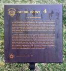
Inscription
A familiar trend of the early Abilene days was for a local businessman to have interests in several aspects of the economy. One such pioneer Abilene merchant was John Edward Johntz. He, along with other noteable businessmen of the time, had an interest in the Rice, Johntz, Nicolay Lumber Company, the Johntz Bros., Gordon and Giles Elevators, and the Johntz, Rice, and Nicolay Milling Company. This milling company eventually became the Security Mills of Abilene. Johntz was also a founder of the Citizens Bank.
John E. and Hettie Johntz were married in 1870 and built their first home in that year on this site. By 1880, as the Johntz businesses prospered, plans were under way to remove the original building and replace it with this beautiful, stately home. With his interest in the lumber com[pany] only the finest materials were used in the construction and the walls of brick were made over one foot thick. The home was always open to friends and the Johntz hospitality played a major part in lifting the social life in Abilene. Johntz's sons built two more of Abilene's outstanding homes. Christian built the home on the northwest corner of this intersection and J. Edward built the home at 307 North Vine.
John E. and Hettie Johntz were married in 1870 and built their first home in that year on this site. By 1880, as the Johntz businesses prospered, plans were under way to remove the original building and replace it with this beautiful, stately home. With his interest in the lumber com[pany] only the finest materials were used in the construction and the walls of brick were made over one foot thick. The home was always open to friends and the Johntz hospitality played a major part in lifting the social life in Abilene. Johntz's sons built two more of Abilene's outstanding homes. Christian built the home on the northwest corner of this intersection and J. Edward built the home at 307 North Vine.
Details
| HM Number | HMXF9 |
|---|---|
| Tags | |
| Marker Number | 4 |
| Year Placed | 1976 |
| Placed By | Abilene Bicentennial Project |
| Marker Condition |           8 out of 10 (1 reports) |
| Date Added | Friday, October 17th, 2014 at 3:45pm PDT -07:00 |
Pictures
Photo Credits: [1] TIM SHEEHAN
Locationbig map
| UTM (WGS84 Datum) | 14S E 654315 N 4309094 |
|---|---|
| Decimal Degrees | 38.91720000, -97.22003333 |
| Degrees and Decimal Minutes | N 38° 55.032', W 97° 13.202' |
| Degrees, Minutes and Seconds | 38° 55' 1.92" N, 97° 13' 12.12" W |
| Driving Directions | Google Maps |
| Area Code(s) | 785 |
| Closest Postal Address | At or near 248-298 N Walnut St, Abilene KS 67410, US |
| Alternative Maps | Google Maps, MapQuest, Bing Maps, Yahoo Maps, MSR Maps, OpenCycleMap, MyTopo Maps, OpenStreetMap |
Is this marker missing? Are the coordinates wrong? Do you have additional information that you would like to share with us? If so, check in.
Nearby Markersshow on map
Maintenance Issues
- Is this marker part of a series?
- What historical period does the marker represent?
- What historical place does the marker represent?
- What type of marker is it?
- What class is the marker?
- What style is the marker?
- This marker could use another picture or two.
- Can this marker be seen from the road?
- Is the marker in the median?

Comments 0 comments