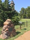
Inscription
Completed in 1880 the Lebold Mansion was built by C.H. Lebold a local banker, realtor, politician, and entrepreneur. Lebold chose the site of Abilene's first log cabin to build his 23 room home of rough hewn brown limestone blocks, from Russell County, and whitish trim stone from Ellis County. The mansion was completed at a cost of $18,000.00.
Lebold's financial empire suffered during the Depression of the 1880's, and in 1889 he was forced to turn the house over to creditors. George Sterl bought the mansion at a sheriff's sale and occupied it until 1918. Hard times soon befell the stately structure, and for the next 53 years it was used at various times as a home for telephone operators, an orphanage, and an apartment building with 15 units.
In March 1972, the road to restoration began when Kurt and Kathy Kessinger acquired the property and returned it to a single family residence. They began the early phase of restoration and placed it on the National Register of Historic Places.
In January 1975, Fred and Merle Vahsholtz acquired the property and completed the early restoration process with an extensive focus on the exterior and surrounding grounds. They opened the home to the public for touring in 1976.
In November 2000, the third generation of caretakers began the next phase of restoration to the mansion. Larkin Mayo and Gary Yuschalk specialists in Victorian restoration purchased the mansion and have completed the final exterior details and have returned the interior back to an 1880's decorative scheme.
Details
| HM Number | HMXFN |
|---|---|
| Tags | |
| Marker Condition | No reports yet |
| Date Added | Friday, October 10th, 2014 at 12:07pm PDT -07:00 |
Pictures
Photo Credits: [1] TIM SHEEHAN [2] TIM SHEEHAN [3] TIM SHEEHAN
Locationbig map
| UTM (WGS84 Datum) | 14S E 654027 N 4308892 |
|---|---|
| Decimal Degrees | 38.91543333, -97.22340000 |
| Degrees and Decimal Minutes | N 38° 54.926', W 97° 13.404' |
| Degrees, Minutes and Seconds | 38° 54' 55.56" N, 97° 13' 24.24" W |
| Driving Directions | Google Maps |
| Area Code(s) | 785 |
| Closest Postal Address | At or near 106 N Vine St, Abilene KS 67410, US |
| Alternative Maps | Google Maps, MapQuest, Bing Maps, Yahoo Maps, MSR Maps, OpenCycleMap, MyTopo Maps, OpenStreetMap |
Is this marker missing? Are the coordinates wrong? Do you have additional information that you would like to share with us? If so, check in.
Nearby Markersshow on map
Maintenance Issues
- Is this marker part of a series?
- What historical period does the marker represent?
- What historical place does the marker represent?
- What type of marker is it?
- What class is the marker?
- What style is the marker?
- Does the marker have a number?
- What year was the marker erected?
- Who or what organization placed the marker?
- Can this marker be seen from the road?
- Is the marker in the median?


Comments 0 comments