Inscription
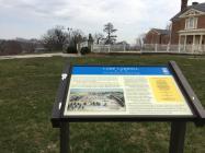
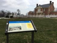
From Plantation to Federal Camp
This land was part of a 2,568-acre tract named Georgia Plantation, that Charles Carroll purchased in 1732. By 1760, his son Charles Carroll, a lawyer, had constructed a Georgian summer home, Mount Clare. the Carroll family lived here until 1852.In April 1861, in the first bloodshed of the Civil War, a crowd of Confederate sympathizers in Baltimore attacked the 6th Massachusetts Infantry as it passed through the city en rout to Washington. By summer the U.S. Army had established camps throughout Baltimore. Brig. Gen. John Reese Kenly, of the Maryland militia, opened a recruiting office and a month later took command of the 1st Maryland Infantry as colonel. He converted the pastures to the west of Mount Clare, then a hotel, into a training facility named Camp Carroll.
On March 22, 1862 the U.S. Army created the Middle Department in Baltimore to protect rail and communication lines. Gen. James Cooper's brigade, organized in April, including troops stationed here at Camp Carroll near the Baltimore and Ohio Railroad line. The brigade was disbanded on May 25, 1862. Units were trained here in drill, guard, and patrol duties. Officers may have been quartered in the Mount Clare Hotel, which offered an outstanding view of the camp. In the fall of 1862, Camp Carroll was renamed Camp Chesebrough, honoring Lt. Colonel William G. Chesebrough, 17th U.S. Infantry. In 1864 the name reverted to Camp Carroll. The camp remained in use by Federal forces until the war ended.
Details
| HM Number | HM10P |
|---|---|
| Series | This marker is part of the Maryland Civil War Trails series |
| Tags | |
| Historical Period | 19th Century, Civil War |
| Historical Place | Hotel, Military Installation |
| Marker Type | Historic District |
| Marker Class | Historical Marker |
| Marker Style | Free Standing |
| Placed By | Maryland Civil War Trails |
| Marker Condition | No reports yet |
| Date Added | Thursday, September 11th, 2014 at 4:47pm PDT -07:00 |
Pictures
Photo Credits: [1] SEPTEMBERSPARROW1666 [2] SEPTEMBERSPARROW1666 [3] SEPTEMBERSPARROW1666 [4] SEPTEMBERSPARROW1666
Locationbig map
| UTM (WGS84 Datum) | 18S E 358240 N 4349036 |
|---|---|
| Decimal Degrees | 39.27910000, -76.64353333 |
| Degrees and Decimal Minutes | N 39° 16.746', W 76° 38.612' |
| Degrees, Minutes and Seconds | 39° 16' 44.7600" N, 76° 38' 36.7200" W |
| Driving Directions | Google Maps |
| Area Code(s) | 410 |
| Can be seen from road? | Yes |
| Is marker in the median? | No |
| Which side of the road? | Marker is on the right when traveling East |
| Closest Postal Address | At or near 699 S Fulton Ave, Baltimore MD 21223, US |
| Alternative Maps | Google Maps, MapQuest, Bing Maps, Yahoo Maps, MSR Maps, OpenCycleMap, MyTopo Maps, OpenStreetMap |
Is this marker missing? Are the coordinates wrong? Do you have additional information that you would like to share with us? If so, check in.
Nearby Markersshow on map


Comments 0 comments